
Hide
Carleton In Craven
hide
Hide
hide
Hide
Hide
The Ancient Parish of CARLETON IN CRAVEN
[Transcribed information mainly from the early 1820s]
"CARLETON IN CRAVEN, (or Carlton) a parish-town, in the east-division and liberty of Staincliffe; 2 miles SW. of Skipton, 10 from Keighley and Colne, 43 from York. Pop. 1218. The Church is a vicarage, dedicated to St. Mary, in the deanry of Craven, value, ~£5. 2s. 1d. p.r. £52. 15s. Patron, the Dean and Canons of Christ church, Oxford.About the year 1700, Mr. Farrand Spence founded an Hospital here, for twelve widows belonging to the parish of Carlton, and six to Market Bosworth, in Leicestershire. Their receipts, about twenty guineas per annum. And about the year 1705, a School was founded by Mrs. Elizabeth Wilkinson, for clothing and educating four boys of this parish, and apprenticing them out at the age of fourteen. The charity is now extended to twenty boys, but only four clothed annually."
"DALE END, in the township and parish of Carleton in Craven, liberty of Staincliffe; 6 miles from Skipton, 9 from Keighley, the end of Lothersdale, and where the Quakers have a burial ground."
"LOTHERSDALE, in the parish of Carleton in Craven, east-division and liberty of Staincliffe; 4 miles SW. of Skipton, 6 from Colne, (Lanc.) 8 from Keighley.
"It is," says Whitaker's Craven, "a dreary valley, running up into Pinhow, as far the confines of the parish of Whalley, (Lanc.) It is a distinct Manor, the property of Lord George Cavendish"."
[Description(s) edited from various 19th century sources by Colin Hinson © 2013]
Hide
- Here are photographs of Churches etc. in the parish:
- St. Mary's Church, Carleton in Craven.
- The Primitive Methodist Church, Carleton in Craven.
- Christ Church, Lothersdale.
- Internal view looking down the nave
- Methodist Chapel, Lothersdale.
- Transcript of the entry for Carleton in Craven in the "Collections relative to Churches and Chapels".
- The whereabouts and dates of the Registers etc. for the Parish of Carleton in Craven.
- The Carlton Web maintains information about the local community, history etc. There is also a gallery of local photographs, old and new.
- Transcript of the entry of "professions and trades" in the Baines's Directory and Gazetteer, Vol I, West Riding.
- Transcript of the entry of "professions and trades" in the Craven Household Almanack 1911, XXX
- There is further information about this parish from the Pigot's 1834 Directory, Yorkshire section.
- There is further information about this parish from the National Gazetteer 1868, Yorkshire extracts.
- There is further information about this parish from the Lewis's Topographical Dictionary of England, Yorkshire extracts.
- Ask for a calculation of the distance from Carleton In Craven to another place.
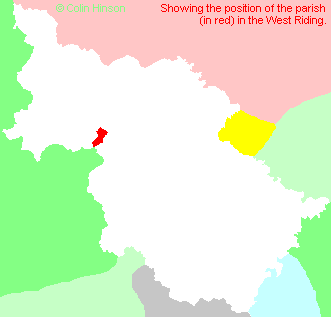
- For a detailed map of this parish see this parish boundaries map.
- For a more detailed map of the parishes in the riding please see the Yorkshire parish maps page.
- For a more detailed map of the county please see the Yorkshire map page.
- Here is a map showing the wapentakes for the county.
You can see maps centred on OS grid reference SD972497 (Lat/Lon: 53.943401, -2.044144), Carleton In Craven which are provided by:
- OpenStreetMap
- Google Maps
- StreetMap (Current Ordnance Survey maps)
- Bing (was Multimap)
- Old Maps Online
- National Library of Scotland (Old Ordnance Survey maps)
- Vision of Britain (Click "Historical units & statistics" for administrative areas.)
- English Jurisdictions in 1851 (Unfortunately the LDS have removed the facility to enable us to specify a starting location, you will need to search yourself on their map.)
- Magic (Geographic information) (Click + on map if it doesn't show)
- GeoHack (Links to on-line maps and location specific services.)
- All places within the same township/parish shown on an Openstreetmap map.
- Nearby townships/parishes shown on an Openstreetmap map.
- Nearby places shown on an Openstreetmap map.
- The World War I Memorial Plaque in Christ Church, Lothersdale.
- The following places are within the boundaries of this (ancient) parish, but I have no further information on them other than the Ordnance Survey Landranger Grid reference shown:
- (SD943457) Raygill
- This parish is covered by the following Society:
- A list of those paying the 1379 Subsidy Rolls (Poll Tax) for this parish.