
Hide
Kirk Deighton
hide
Hide
hide
Hide
Hide
The Ancient Parish of KIRK DEIGHTON
[Transcribed information mainly from the early 1820s]
"KIRK DEIGHTON, a parish-town in the upper-division of Claro; (the seat of the Rev. J. Geldart, L.L.D.) 1½ miles N. of Wetherby, 5½ from Knaresborough, 16½ from York. Pop. 371. The Church is a rectory, dedicated to All Saints, in the deanry of the Ainsty, value, £15. 11s. 10½d. Patron, Rev. Jas. Geldart, L.L.D.""INGMANTHORPE, a hamlet in the township and parish of Kirk Deighton; (the seat of Richard Fountayne Wilson Esq.) 3 miles from Wetherby, 7 from Knaresborough, 12½ from York.
This was anciently part of the possessions of the Barons Trusbuts; from whom it descended to Lord Ross, and was the principal residence of the descendants of that noble family, for many generations. Here was a Chapel, dedicated to St. Mary, in which Sir Robert Ross was interred on the 21st of January, 1393. The site of the house, gardens, &c. may yet be traced, in a field, called Hall Garth."
"NORTH DEIGHTON, in the parish of Kirk Deighton, upper division of Claro; (the seat of John Brewin, Esq.) 2 miles NW. of Wetherby, 4½ from Knaresborough. Pop. 141." (There is further information for North Deighton).
[Description(s) edited from various 19th century sources by Colin Hinson © 2013]
Hide
- Here are photographs of Churches etc. in the parish:
- All Saints' Church, Kirk Deighton.
- Internal view looking down the nave
- The former Methodist Chapel, Kirk Deighton, now a private dwelling.
- All Saints' Church, Kirk Deighton.
- Transcript of the entry for Kirk Deighton in the "Collections relative to Churches and Chapels".
- The whereabouts and dates of the Registers etc. for the Parish of Kirk Deighton.
- Transcript of the entry of "professions and trades" in the Baines's Directory and Gazetteer, Vol I, West Riding.
- There is further information about this parish from the National Gazetteer 1868, Yorkshire extracts.
- There is further information about this parish from the Lewis's Topographical Dictionary of England, Yorkshire extracts.
- Ask for a calculation of the distance from Kirk Deighton to another place.
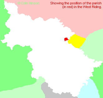
- For a detailed map of this parish see this parish boundaries map.
- For a more detailed map of the parishes in the riding please see the Yorkshire parish maps page.
- For a more detailed map of the county please see the Yorkshire map page.
- Here is a map showing the wapentakes for the county.
You can see maps centred on OS grid reference SE398503 (Lat/Lon: 53.94728, -1.395094), Kirk Deighton which are provided by:
- OpenStreetMap
- Google Maps
- StreetMap (Current Ordnance Survey maps)
- Bing (was Multimap)
- Old Maps Online
- National Library of Scotland (Old Ordnance Survey maps)
- Vision of Britain (Click "Historical units & statistics" for administrative areas.)
- English Jurisdictions in 1851 (Unfortunately the LDS have removed the facility to enable us to specify a starting location, you will need to search yourself on their map.)
- Magic (Geographic information) (Click + on map if it doesn't show)
- GeoHack (Links to on-line maps and location specific services.)
- All places within the same township/parish shown on an Openstreetmap map.
- Nearby townships/parishes shown on an Openstreetmap map.
- Nearby places shown on an Openstreetmap map.
- The World War I Memorial Plaque in All Saints Church, Kirk Deighton.
- The World War I Memorial Plaque in All Saints Church, Kirk Deighton.
- The following places are within the boundaries of this (ancient) parish, but I have no further information on them other than the Ordnance Survey Landranger Grid reference shown:
- (SE388517) The Manor
- This parish is covered by the following Society:
- A list of those paying the 1379 Subsidy Rolls (Poll Tax) for this parish.