
Hide
Pannal
hide
Hide
hide
Hide
Hide
The Ancient Parish of PANNAL
[Transcribed information mainly from the early 1820s]
"PANNAL, a parish-town, in the lower-division of Claro; 2½ miles S. of Harrogate, 5½ from Knaresborough, 6 from Ripley, 8 from Otley, 23½ from York. Pop. 1,314. The Church is a vicarage, dedicated to St. Robert (see Churches for photograph), Knaresborough, in the deanry of the Ainsty, value, ~£5. 5s. Patron, the Rev. R.B. Hunter.The first Minister that occurs, is John Brown, one of the brethren of the house of St. Robert, Knaresborough, 1348: and in the following year, the church was given, by the Earl of Cornwall, to the brethren of the said Priory.
Pannal was anciently called Rosehurst, by contraction, Rossett. --History of Knaresborough."
"BECKWITH, scattered houses, in the township and parish of Pannal, liberty of Knaresborough; 2½ miles from Harrogate."
"BECKWITH GREEN, and Beckwithshaw, in the parish of Pannal, liberty of Knaresborough; 2½ miles from Harrogate.
The original seat of the ancient family of Beckwith, the last remains of whose property here, was purchased about the year 1753, by Edwin Lacelles, Esq. of Mr. John Beckwith, of Knaresborough, a lineal descendant of that ancient house. --Hargrove."
"BRACKENTHWAITE, scattered hs. in the township and parish of Pannal; 5½ miles S. of Ripley, 6 from Knaresborough."
"CRIMPLE HOUSE, (the residence of Mrs. Bainbridge,) in the township and parish of Pannal; 2 miles from Harrogate, 5 from Knaresborough."
"LOW HARROGATE, in the township and parish of Pannal, lower-division of Claro, liberty of Knaresborough; 3½ miles from Knaresborough. Principal Inns, the Crown, White Hart, Swan, Crescent, and Hotel.
Please note:The modern (2001) Harrogate is a large town which combines the old Low Harrogate (Pannal Parish) and High Harrogate (Knaresborough Parish). As the borders of the parishes changed several times, in order to avoid confusion, all Harrogate data (Churches, War memorials, etc. etc) is included with Knaresborough parish."
"LUND HOUSE GREEN, scattered houses in the township and parish of Pannal; 5½ miles SW. of Knaresborough."
[Description(s) edited from various 19th century sources by Colin Hinson © 2013]
Hide
- Here are 2 photographs of the Cemetery in Low Harrogate:
- The Cemetery Chapel, Low Harrogate.
- The Cemetery, Low Harrogate.
- Here are photographs of Churches etc. in the parish:
- St. Robert's Church, Pannal (view 1).
- St. Robert's Church, Pannal (view 2).
- St. Robert's Church, Pannal (view 3).
- St. Michael and All Angels' Church, Beckwithshaw.
- Harlow Hill Methodist Church, Low Harrogate.
- Transcript of the entry for Pannal in the "Collections relative to Churches and Chapels".
- Transcript of the entry for Low Harrowgate in the "Collections relative to Churches and Chapels".
- The whereabouts and dates of the Registers etc. for the Parish of Pannal.
- The whereabouts and dates of the Registers etc. for the Chapelry of Harrogate St Mary.
- Transcript of the entry of "professions and trades" in the Baines's Directory and Gazetteer, Vol I, West Riding.
- Transcript of the entry of "professions and trades" in the Pigot's 1834 Directory, Yorkshire section.
- Transcript of the entry of "professions and trades" in the White's 1837 Gazetteer, History and Directory, of the West Riding.
- There is further information about this parish from the Pigot's 1834 Directory, Yorkshire section.
- There is further information about this parish from the White's 1837 Gazetteer, History and Directory, of the West Riding.
- There is further information about this parish from the National Gazetteer 1868, Yorkshire extracts.
- There is further information about this parish from the Lewis's Topographical Dictionary of England, Yorkshire extracts.
- Ask for a calculation of the distance from Pannal to another place.
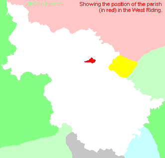
- For a detailed map of this parish see this parish boundaries map.
- For a more detailed map of the parishes in the riding please see the Yorkshire parish maps page.
- For a more detailed map of the county please see the Yorkshire map page.
- Here is a map showing the wapentakes for the county.
You can see maps centred on OS grid reference SE307517 (Lat/Lon: 53.96048, -1.533595), Pannal which are provided by:
- OpenStreetMap
- Google Maps
- StreetMap (Current Ordnance Survey maps)
- Bing (was Multimap)
- Old Maps Online
- National Library of Scotland (Old Ordnance Survey maps)
- Vision of Britain (Click "Historical units & statistics" for administrative areas.)
- English Jurisdictions in 1851 (Unfortunately the LDS have removed the facility to enable us to specify a starting location, you will need to search yourself on their map.)
- Magic (Geographic information) (Click + on map if it doesn't show)
- GeoHack (Links to on-line maps and location specific services.)
- All places within the same township/parish shown on an Openstreetmap map.
- Nearby townships/parishes shown on an Openstreetmap map.
- Nearby places shown on an Openstreetmap map.
- The following places are within the boundaries of this (ancient) parish, but I have no further information on them other than the Ordnance Survey Landranger Grid reference shown:
- (SE281524) Beckwith House
- (SE302515) Burn Bridge
- (SE297519) Daw Cross
- (SE285540) Harlow Car
- (SE288541) Harlow Hill
- (SE290517) Hill Top Hall
- (SE285531) Lund House
- (SE258533) Moor Park
- (SE310536) Oatlands
- (SE295528) Pannal Ash
- (SE299528) Rossett Green
- (SE269525) Shaw Green
- (SE260519) Shawfield Head
- (SE274518) Tatefield Hall
- (SE297522) Yew Tree
- This parish is covered by the following Society:
- A list of those paying the 1379 Subsidy Rolls (Poll Tax) for this parish.