
Hide
Sherburn In Elmet
hide
Hide
hide
Hide
Hide
The Ancient Parish of SHERBURN IN ELMET
[Transcribed information mainly from the early 1820s]
"SHERBURN IN ELMET, a market and parish-town, in the wapentake of Barkston-Ash, a part in the liberty of St Peter; 3½ miles from Aberford, 6 from Ferrybridge, 7 from Tadcaster and Pontefract, 8 from Selby, 12½ from Leeds, 15 from York, 183 from London. Market, Friday. Fair, September 25, for horses, linen, &c. Principal Inn, Red Bear. Pop. 1,144. The Church, peculiar, is a Vicarage, dedicated to All-Saints (see Churches for photograph), in the deanry of the Ainsty, value, £10. 17s. 1d. p.r. £130. Patron, the Prebendary of Fenton." (There is further information for Sherburn In Elmet).Information on the following places in this Parish is contained on a supplementary page.
|
|
[Description(s) edited from various 19th century sources by Colin Hinson © 2013]
Hide
- Michael Halton has transcribed the Memorial Inscriptions for South Milford, and he has also drawn a plan of the graveyard.
- Here are photographs of Churches in the parish:
- All Saints' Church, Sherburn in Elmet (view 1). (The Church's website is here.)
- All Saints' Church, Sherburn in Elmet (view 2).
- All Saints' Church, Sherburn in Elmet in the snow.
- Holy Trinity Church, Barkston Ash (view 1).
- Holy Trinity Church, Barkston Ash (view 2). (The Church's website is here.)
- St. Mary's Church, South Milford (view 1). (The Church's website is here.)
- St. Mary's Church, South Milford (view 2).
- The Church of St. Mary the Virgin, Micklefield (view 1).
- The Church of St. Mary the Virgin, Micklefield (view 2).
- Internal view looking down the nave
- The font and cover
- The Methodist Church, Sherburn in Elmet.
- The Roman Catholic Church, Sherburn in Elmet.
- The Methodist Church, South Milford.
- Lotherton Hall Chapel, Lotherton.
- Transcript of the entry for Sherburn in Elmet in the "Collections relative to Churches and Chapels".
- Peter Watkinson has transcribed the entries for Burials for South Milford Church from its commission in 1847 to the present day. There are two files, one dealing with Burials 1847 to 1979 and the other dealing with Burials 1979 to 1998 when the dates of death started to be entered.
- The whereabouts and dates of the Registers etc. for the Parish of Sherburn in Elmet.
- Transcript of the entry of "professions and trades" in the Baines's Directory and Gazetteer, Vol I, West Riding.
- Transcript of the entry of "professions and trades" in the Pigot's 1829 Directory, Yorkshire section.
- Transcript of the entry of "professions and trades" in the Pigot's 1834 Directory, Yorkshire section.
- Transcript of the entry of "professions and trades" in the White's 1837 Gazetteer, History and Directory, of the West Riding.
- There is further information about this parish from the Pigot's 1829 Directory, Yorkshire section.
- There is further information about this parish from the Pigot's 1834 Directory, Yorkshire section.
- There is further information about this parish from the White's 1837 Gazetteer, History and Directory, of the West Riding.
- There is further information about this parish from the National Gazetteer 1868, Yorkshire extracts.
- There is further information about this parish from the Lewis's Topographical Dictionary of England, Yorkshire extracts.
- There is further information about this parish from the Stephen Whatley's Gazetteer 1750, Yorkshire extracts.
- Ask for a calculation of the distance from Sherburn In Elmet to another place.
- Here is a photograph of Steeton Hall Gateway, near South Milford.
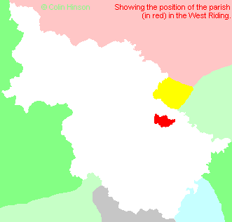
- For a detailed map of this parish see this parish boundaries map.
- For a more detailed map of the parishes in the riding please see the Yorkshire parish maps page.
- For a more detailed map of the county please see the Yorkshire map page.
- Here is a map showing the wapentakes for the county.
You can see maps centred on OS grid reference SE495335 (Lat/Lon: 53.795463, -1.250022), Sherburn In Elmet which are provided by:
- OpenStreetMap
- Google Maps
- StreetMap (Current Ordnance Survey maps)
- Bing (was Multimap)
- Old Maps Online
- National Library of Scotland (Old Ordnance Survey maps)
- Vision of Britain (Click "Historical units & statistics" for administrative areas.)
- English Jurisdictions in 1851 (Unfortunately the LDS have removed the facility to enable us to specify a starting location, you will need to search yourself on their map.)
- Magic (Geographic information) (Click + on map if it doesn't show)
- GeoHack (Links to on-line maps and location specific services.)
- All places within the same township/parish shown on an Openstreetmap map.
- Nearby townships/parishes shown on an Openstreetmap map.
- Nearby places shown on an Openstreetmap map.
- The 1914-1918 and 1939-45 War Memorial in Holy Trinity churchyard, Barkston Ash.
- The Memorial for the 1896 Micklefield Colliery explosion in St. Mary's Churchyard, Micklefield.
- The Calvary in St. Mary's Churchyard, Micklefield
- The following places are within the boundaries of this (ancient) parish, but I have no further information on them other than the Ordnance Survey Landranger Grid reference shown:
- (SE445325) New Micklefield
- (SE442337) Old Micklefield
- This parish is covered (or partly covered) by the following Societies:
- A list of those paying the 1379 Subsidy Rolls (Poll Tax) for this parish.