Hide
Slaidburn
hide
Hide
hide
Hide
Hide
The Ancient Parish of SLAIDBURN
[Transcribed information mainly from the early 1820s]
"SLAIDBURN, a parish-town, in the west division of Staincliffe, liberty of Bowland; 9 miles NW. of Clitheroe, (Lanc.) 10 from Gisburn, and Long Preston, 12 from Settle, 20 from Lancaster and Blackburn, (Lanc.) 21 from Skipton, 62 from York. No Market. Fairs, Wednesday before Easter, and November 4. Principal Inn, Hark to Bounty. Pop. 914. The Church is a rectory, dedicated to Saint Andrew, in the deanry of Craven, value £28. Patron the Rev. Henry Wigglesworth.The Church is a large handsome structure, of red Fell stone, built about the time of Henry VIII. and appears to have been repaired in 1726. Within the altar is a stone, inscribed to the memory of Nicholas Townley, dated 1693.
This place is situated near the western extremity of the Forest of Bowland, on the borders of Lancashire.
Here is a Free Grammar School, which was erected and Endowed by John Brennand late of Panehill in this Parish. Gentleman who died the 15th day of May in the year of our Lord 1717. The Master's salary £50. and the Usher or second Master, about £20. per annum. The Courts Leet for the higher division of the Forest of Bowland are held here.
"Henry de Lacy, Earl of Lincoln, procured a charter for a Fair at Slaydburn, on the eve and festival of St. Peter ad Vinc. and two days after." --Whitaker's Craven."
Information on the following places in this Parish is contained on a supplementary page.
|
|
|
[Description(s) edited from various 19th century sources by Colin Hinson © 2013]
Hide
- Here are photographs of Churches etc. in the parish:
- St. Andrew's Church, Slaidburn. (The Church's website is here.)
- St. George's Church, Dunsop Bridge. (The Church's website is here.)
- St. Hubert's Roman Catholic Church, Dunsop Bridge. (The Church's website is here.)
- Congregational Chapel, Newton.
- St. James's Church, Stocks in Bowland. (The Church's website is here.)
- A transcription of the Newton-In-Bowland Congregational Church History
- Transcript of the entry for Slaidburn in the "Collections relative to Churches and Chapels".
- The whereabouts and dates of the Registers etc. for the Parish of Slaidburn.
- Transcript of the entry of "professions and trades" in the Baines's Directory and Gazetteer, Vol I, West Riding.
- There is further information about this parish from the National Gazetteer 1868, Yorkshire extracts.
- There is further information about this parish from the Lewis's Topographical Dictionary of England, Yorkshire extracts.
- There is further information about this parish from the Stephen Whatley's Gazetteer 1750, Yorkshire extracts.
- Ask for a calculation of the distance from Slaidburn to another place.
- The Dalehead and Stocks in Bowland website would be very pleased to hear from anyone who can help them in adding to the history and genealogical past for those two places. Stocks in Bowland is now submerged under the reservoir.
- The Dalehead and Stocks in Bowland website would be very pleased to hear from anyone who can help them in adding to the history and genealogical past for those two places. Stocks in Bowland is now submerged under the reservoir.
- A transcription of the Newton-In-Bowland Congregational Church History

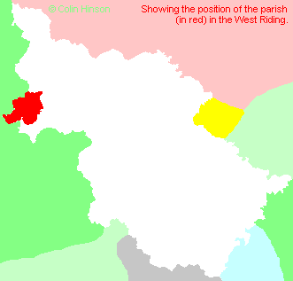
- For a detailed map of this parish see this parish boundaries map.
- For a more detailed map of the parishes in the riding please see the Yorkshire parish maps page.
- For a more detailed map of the county please see the Yorkshire map page.
- Here is a map showing the wapentakes for the county.
You can see maps centred on OS grid reference SD711524 (Lat/Lon: 53.966862, -2.442015), Slaidburn which are provided by:
- OpenStreetMap
- Google Maps
- StreetMap (Current Ordnance Survey maps)
- Bing (was Multimap)
- Old Maps Online
- National Library of Scotland (Old Ordnance Survey maps)
- Vision of Britain (Click "Historical units & statistics" for administrative areas.)
- English Jurisdictions in 1851 (Unfortunately the LDS have removed the facility to enable us to specify a starting location, you will need to search yourself on their map.)
- Magic (Geographic information) (Click + on map if it doesn't show)
- GeoHack (Links to on-line maps and location specific services.)
- All places within the same township/parish shown on an Openstreetmap map.
- Nearby townships/parishes shown on an Openstreetmap map.
- Nearby places shown on an Openstreetmap map.
- The War Memorial at Slaidburn (with plaques for Dunsop and Newton).
- The War Memorial at Dunsop Bridge
- The Monumental Inscriptions for St. Andrew's Church, Slaidburn on Kate Hurst's web-site.
- The Monumental Inscriptions for St. Hubert's Church, Dunsop Bridge on Kate Hurst's web-site.
- The Monumental Inscriptions for St. Helen's Church, Waddington on Kate Hurst's web-site.
- This parish is covered by the following Society:
- A list of those paying the 1379 Subsidy Rolls (Poll Tax) for this parish.

