
Hide
Thorne
hide
Hide
hide
Hide
Hide
The Ancient Parish of THORNE
[Transcribed information mainly from the early 1820s]
"THORNE, a market and parish-town, in the lower-division of Strafforth and Tickhill; (the seats of Henry Ellison, and R. Pemberton Milnes, Esqrs.) 6 miles from Crowle (Linc.) 7 SE. of Snaith, 11 from Doncaster, 13¼ from Howden, 14 from Bawtry, 30 from York, 170 from London. Market, Wednesday. Fairs, Monday and Tuesday after June 11, and Monday and Tuesday after October 11, for horned cattle, woollen cloth, &c. Principal Inns, White Hart, Red Lion, Granby's Head, and Royal Oak. Pop. 3,463. The Church is a perpetual curacy, dedicated to St. Nicholas (see Churches for photograph), in the deanry of Doncaster, value, p.r. !£72. Patron, Lord Deerhurst, in right of his wife." (There is further information for Thorne)."BANKSIDE, 3 or 4 farm-houses in the township and parish of Thorne; 4 miles SE. of Snaith and 4 from Thorne."
"BRADHOLME, a farm-house in the township and parish of Thorne, liberty of Tickhill; 1½ mile S. of Thorne."
"DIKES MARSH, 2 farm-houses in the township and parish of Thorne; 2 miles N. of Thorne."
"LONG JOHNNY MOOR, a hamlet in the township and parish of Thorne; 3 miles from Thorne, 11 from Howden."
"MOORENDS, scattered farm-houses in the township and parish of Thorne; 1½ mile N. of Thorne, 13 from Howden."
"THORNE QUAY, or WHARFE, in the township and parish of Thorne; ¾ of a mile N. of Thorne.
Vessels of a sufficiently large size for the coasting trade, are built here, on the banks of the river, the landing place for merchandise; and where a considerable trade is carried on in coals, timber, iron, &c."
[Description(s) edited from various 19th century sources by Colin Hinson © 2013]
Hide
- Here are photographs of Churches etc. in the parish:
- St. Nicholas' Church, Thorne (view 1).
- St. Nicholas' Church, Thorne (view 2).
- St. Nicholas' Church, Thorne (view 3). (The Church's website is here.)
- The Methodist Church, Thorne.
- The old Primitive Methodist Church, Thorne (now a timber merchant's).
- The former Bethesda United Methodist Church, Thorne.
- St. Wilfrith's Church, Moorends.
- The Roman Catholic Church of St. Joseph and St. Nicholas, Moorends.
- The National Spiritualist Church, Moorends.
- The Kingdom Hall of Jehovah's Witnesses, Moorends.
- The former Methodist Church, Moorends.
- The former Pentecostal Church, Thorne.
- A transcription of the Thorne With Hatfield Congregational Church History
- Transcript of the entry for Thorne in the "Collections relative to Churches and Chapels".
- The whereabouts and dates of the Registers etc. for the Parish of Thorne.
- Transcript of the entry of "professions and trades" in the Baines's Directory and Gazetteer, Vol I, West Riding.
- Transcript of the entry of "professions and trades" in the Pigot's 1829 Directory, Yorkshire section.
- Transcript of the entry of "professions and trades" in the Pigot's 1834 Directory, Yorkshire section.
- Transcript of the entry of "professions and trades" in the White's 1837 Gazetteer, History and Directory, of the West Riding.
- There is further information about this parish from the Pigot's 1829 Directory, Yorkshire section.
- There is further information about this parish from the Pigot's 1834 Directory, Yorkshire section.
- There is further information about this parish from the White's 1837 Gazetteer, History and Directory, of the West Riding.
- There is further information about this parish from the National Gazetteer 1868, Yorkshire extracts.
- There is further information about this parish from the Lewis's Topographical Dictionary of England, Yorkshire extracts.
- There is further information about this parish from the Stephen Whatley's Gazetteer 1750, Yorkshire extracts.
- Ask for a calculation of the distance from Thorne to another place.
- A transcription of the Thorne With Hatfield Congregational Church History
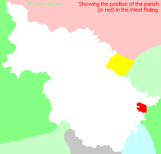
- For a detailed map of this parish see this parish boundaries map.
- For a more detailed map of the parishes in the riding please see the Yorkshire parish maps page.
- For a more detailed map of the county please see the Yorkshire map page.
- Here is a map showing the wapentakes for the county.
You can see maps centred on OS grid reference SE686134 (Lat/Lon: 53.612668, -0.964553), Thorne which are provided by:
- OpenStreetMap
- Google Maps
- StreetMap (Current Ordnance Survey maps)
- Bing (was Multimap)
- Old Maps Online
- National Library of Scotland (Old Ordnance Survey maps)
- Vision of Britain (Click "Historical units & statistics" for administrative areas.)
- English Jurisdictions in 1851 (Unfortunately the LDS have removed the facility to enable us to specify a starting location, you will need to search yourself on their map.)
- Magic (Geographic information) (Click + on map if it doesn't show)
- GeoHack (Links to on-line maps and location specific services.)
- All places within the same township/parish shown on an Openstreetmap map.
- Nearby townships/parishes shown on an Openstreetmap map.
- Nearby places shown on an Openstreetmap map.
- The following places are within the boundaries of this (ancient) parish, but I have no further information on them other than the Ordnance Survey Landranger Grid reference shown:
- (SE675146) Hangsman Hill
- This parish is covered by the following Society:
- A list of those paying the 1379 Subsidy Rolls (Poll Tax) for this parish.