
Hide
Thurnscoe
hide
Hide
hide
Hide
Hide
The Ancient Parish of THURNSCOE
[Transcribed information mainly from the early 1820s]
"THURNSCOE, a parish-town, in the lower-division of Strafforth and Tickhill, liberty of Tickhill; (the seat of Charles Palmer, Esq.) 7 miles W. of Doncaster, Rotherham, and Barnsley, 36 from York. Pop. 205. The Church is a rectory, dedicated to St. Helen, in the deanry of Doncaster, value, £11. 7s. 8½d. Patron, Earl Fitzwilliam."
[Description(s) edited from various 19th century sources by Colin Hinson © 2013]
Hide
- The Methodist Baptism Registers for Bolton upon Dearne, Goldthorpe and Thurnscoe: 1929-1950,
- Here are photographs of Churches etc. in the parish:
- St. Helen's Church, Thurnscoe, view 1.
- Internal view looking down the nave
- The East Window
- The unusual wooden font
- St. Helen's Church, Thurnscoe, view 2.
- St. Hilda's Church, Thurnscoe, view 1.
- St. Hilda's Church, Thurnscoe, view 2.
- The Methodist Church, Thurnscoe.
- St. Helen's Church, Thurnscoe, view 1.
- Transcript of the entry for Thurnscoe in the "Collections relative to Churches and Chapels".
- The following transcriptions are transcriptions of transcriptions originally done in 1988 by Wath and Mexborough Archives. These documents have many typographical errors and so we cannot vouch for the accuracy in the original transcription. If you find anything of interest here, please be sure to check the original Parish Registers source material.
Transcriptions by Jack Parry of:- The Wesleyan Methodist Baptism Registers for Thurnscoe 1896-1935.
- The Primitive Methodist Baptism Registers for Thurnscoe East, 1906-1964
- The whereabouts and dates of the Registers etc. for the Parish of Thurnscoe.
- The List of Rectors in St. Helen's Church, Thurnscoe.
- The Methodist Baptism Registers for Bolton upon Dearne, Goldthorpe and Thurnscoe: 1929-1950.
- Transcript of the entry of "professions and trades" in the Baines's Directory and Gazetteer, Vol I, West Riding.
- There is further information about this parish from the National Gazetteer 1868, Yorkshire extracts.
- There is further information about this parish from the Lewis's Topographical Dictionary of England, Yorkshire extracts.
- Ask for a calculation of the distance from Thurnscoe to another place.
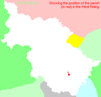
- For a detailed map of this parish see this parish boundaries map.
- For a more detailed map of the parishes in the riding please see the Yorkshire parish maps page.
- For a more detailed map of the county please see the Yorkshire map page.
- Here is a map showing the wapentakes for the county.
You can see maps centred on OS grid reference SE450056 (Lat/Lon: 53.545118, -1.322365), Thurnscoe which are provided by:
- OpenStreetMap
- Google Maps
- StreetMap (Current Ordnance Survey maps)
- Bing (was Multimap)
- Old Maps Online
- National Library of Scotland (Old Ordnance Survey maps)
- Vision of Britain (Click "Historical units & statistics" for administrative areas.)
- English Jurisdictions in 1851 (Unfortunately the LDS have removed the facility to enable us to specify a starting location, you will need to search yourself on their map.)
- Magic (Geographic information) (Click + on map if it doesn't show)
- GeoHack (Links to on-line maps and location specific services.)
- All places within the same township/parish shown on an Openstreetmap map.
- Nearby townships/parishes shown on an Openstreetmap map.
- Nearby places shown on an Openstreetmap map.
- The World War I Memorial Plaque in St. Helen's Church, Thurnscoe.
- This parish is covered by the following Society:
- A list of those paying the 1379 Subsidy Rolls (Poll Tax) for this parish.