
Hide
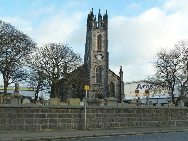
St. Clement, Aberdeen, Church of Scotland
hide
Hide
Hide
St Clement Street,
Aberdeen
Hide
"The parish of St. Clement is to the south-east of the town, in the district of Futtie, and contains a population of 7092; the minister's stipend is £250, arising principally from bequeathed lands. The church, erected in 1787, on the site of an ancient chapel, was afterwards rebuilt, on a larger scale, at an expense of £2600; it is capable of accommodating 1300 persons."
From Samuel Lewis A Topographical Dictionary of Scotland (1851)
Hide
"The history of St. Clement's dates from about the year 1498, when a chapel was built for the devotional use of the white fishers of the village of Futtie. Each fisher then undertook to pay one shilling yearly for each line, and in return the priest was required to celebrate two masses weekly one on Sunday and another on Friday" (Gammie, the Churches of Aberdeen). The present 1828 church is B-listed.
- OpenStreetMap
- Google Maps
- StreetMap (Current Ordnance Survey maps)
- Bing (was Multimap)
- Old Maps Online
- National Library of Scotland (Old Ordnance Survey maps)
- Vision of Britain (Click "Historical units & statistics" for administrative areas.)
- Magic (Geographic information) (Click + on map if it doesn't show)
- GeoHack (Links to on-line maps and location specific services.)