
Hide
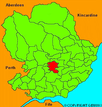
Forfar
hide
Hide
"Forfar, a royal burgh of considerable antiquity, and the county town of Angus, where the sheriff has held his court for upwards of two centuries, being pretty centrally situated for the administration of justice. It is governed by a provost, two bailies and 19 counselors, annually self elected. The streets are irregular; but many of the houses are neat, and well built. The church is elegant and commodious, situated nearly in the centre of the town. The town-house is newly rebuilt; the front towards the market place has a good effect, but the rooms for prisoners are dark and uncomfortable, and the utility of the whole fabric seems to havebeen sacrificed to the attainment of a large upper room for public meetings and amusements. A considerable manufacture of osnabugs and coarse linens is carried on in Forfar; and the making of course linen shoes or brogues, as they are called, employs a considerable number of hands. The parish of Forfar extends about 6 miles in length from north to south and about 5 in breadth. The general appearance is level , with the exception of the hill of Balmashanner, which lies at the south of the town. The soil towards the north and south extremity is light and sandy; about the middle of a spouty clay."
The Gazetteer of Scotland, W Chalmers, Dundee 1803.
Hide
| St John the Evangelist, Forfar, Scottish Episcopal |
| East and Old Parish Church , Forfar, Church of Scotland |
| St James , Forfar, Church of Scotland |
- The transcription of the section for Forfar from the National Gazetteer (1868) provided by Colin Hinson.
- Ask for a calculation of the distance from Forfar to another place.
You can see maps centred on OS grid reference NO467492 (Lat/Lon: 56.631404, -2.869696), Forfar which are provided by:
- OpenStreetMap
- Google Maps
- StreetMap (Current Ordnance Survey maps)
- Bing (was Multimap)
- Old Maps Online
- National Library of Scotland (Old Ordnance Survey maps)
- Vision of Britain (Click "Historical units & statistics" for administrative areas.)
- Magic (Geographic information) (Click + on map if it doesn't show)
- GeoHack (Links to on-line maps and location specific services.)
- All places within the same township/parish shown on an Openstreetmap map.
- Nearby townships/parishes shown on an Openstreetmap map.
- Nearby places shown on an Openstreetmap map.