
Hide
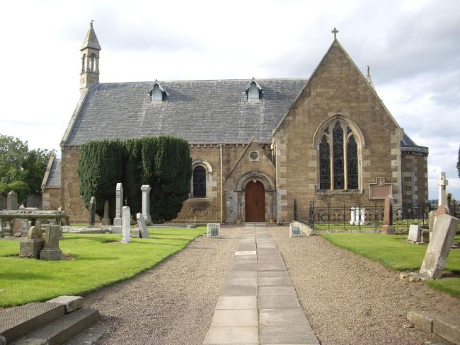
Main Street, Athelstaneford, Church of Scotland
hide
Hide
Hide
Church of Scotland,
Main Street,
Athelstaneford
Hide
By 2022, the church had become part of an extended parish, Traprain, comprising Athelstaneford, Whitekirk, Tyninghame, Prestonkirk & Stenton.
From the Canmore databse : "A church was built in Athelstaneford in 1176 and continued in use until 1780 (T O Duncan 1934). A new church was built about 1784 and was replaced by the present church in 1868. In 1854 part of the original church formed the burial vault of the Kinloch family."
OPRs (Old Parish Registers) are available from 1664 for both Births and Marriages. "This record seems to have been kept with care" (NRS)
It is located at NT5329777341 (Lat/Lon 55.986756, -2.750145). You can see this on maps provided by:
- OpenStreetMap
- Google Maps
- StreetMap (Current Ordnance Survey maps)
- Bing (was Multimap)
- Old Maps Online
- National Library of Scotland (Old Ordnance Survey maps)
- Vision of Britain (Click "Historical units & statistics" for administrative areas.)
- Magic (Geographic information) (Click + on map if it doesn't show)
- GeoHack (Links to on-line maps and location specific services.)
Details of the inscriptions on the "stone of remembrance" can be found in the IWM database.