
Hide
Keith Kirk, Humbie, Church of Scotland
hide
Hide
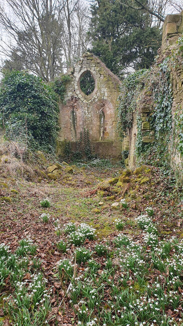
Keith Marischal Kirk interior
© Dave Howie 2024

Keith Marischal Kirk south wall
© dave Howie 2024
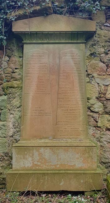
Keith Marischal Kirk, Park family memorial
© Dave Howie 2024
Hide
Keith Kirk,
Humbie
Hide
The church had a graveyard.
Attached to the south wall of the church is an extensive memorial to the Park family throughout the 19th century.
The church here was founded around 1176, with the parish merging with Keith-Hundeby in 1618, ultimately becoming known as Humbie.
Extensive historical information, and photographs, plans, etc, are available from Canmore.
It was located at NT4481964535 (Lat/Lon 55.870806, -2.88338). You can see this on maps provided by:
- OpenStreetMap
- Google Maps
- StreetMap (Current Ordnance Survey maps)
- Bing (was Multimap)
- Old Maps Online
- National Library of Scotland (Old Ordnance Survey maps)
- Vision of Britain (Click "Historical units & statistics" for administrative areas.)
- Magic (Geographic information) (Click + on map if it doesn't show)
- GeoHack (Links to on-line maps and location specific services.)