
Hide
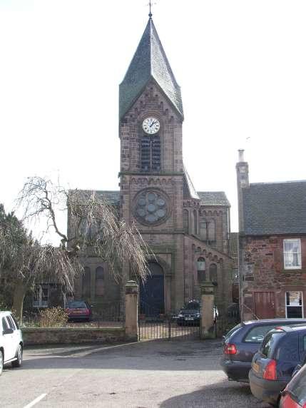
St Andrew's, East Linton, Church of Scotland
hide
Hide
Hide
St Andrew's,
The Square,
East Linton
Hide
The church is shown on the 1894 OS map as "Free Church", information from East Lothian Archives indicates that it then became a United Free Church (in 1900?)
It closed in 1959.
Merged with Prestonkirk congregation in 1959. Building sold in 1996.
It was located at NT5920677200 (Lat/Lon 55.986029, -2.655419). You can see this on maps provided by:
- OpenStreetMap
- Google Maps
- StreetMap (Current Ordnance Survey maps)
- Bing (was Multimap)
- Old Maps Online
- National Library of Scotland (Old Ordnance Survey maps)
- Vision of Britain (Click "Historical units & statistics" for administrative areas.)
- Magic (Geographic information) (Click + on map if it doesn't show)
- GeoHack (Links to on-line maps and location specific services.)