
Hide
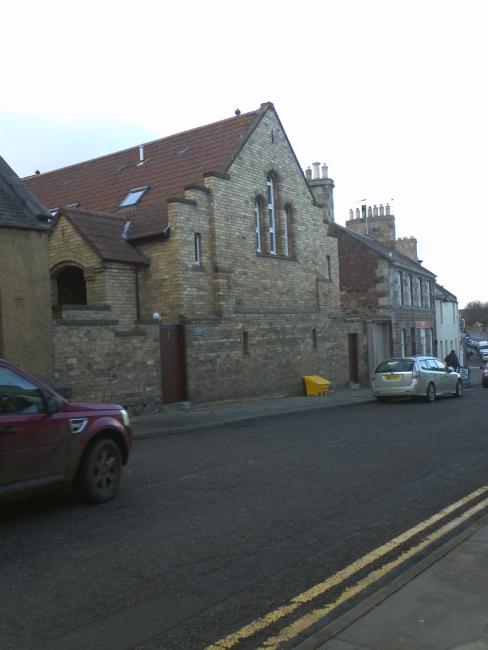
St Kentigern's, East Linton, Roman Catholic
hide
Hide
Hide
St Kentigern's,
High Street,
East Linton
Hide
It was founded in 1913. It closed in 1979.
The last service was in 1979, with the building sold, and subsequently converted to a house, in 1992.
It was located at NT5914377331 (Lat/Lon 55.9872, -2.656448). You can see this on maps provided by:
- OpenStreetMap
- Google Maps
- StreetMap (Current Ordnance Survey maps)
- Bing (was Multimap)
- Old Maps Online
- National Library of Scotland (Old Ordnance Survey maps)
- Vision of Britain (Click "Historical units & statistics" for administrative areas.)
- Magic (Geographic information) (Click + on map if it doesn't show)
- GeoHack (Links to on-line maps and location specific services.)