
Hide
Kirk Street, Prestonpans, Church of Scotland
hide
Hide
Hide
Church of Scotland,
Kirk Street,
Prestonpans
Hide
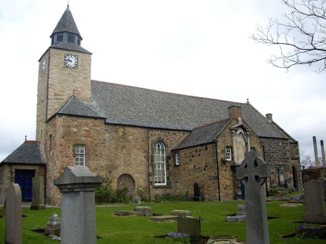
An early church was destroyed in 1544, with a new church built in 1595. The current building, incorporating parts of the older structure, dates from 1774.
The Canmore database includes a number of photos, architectural plans, etc.
OPRs (Old Parish Registers) are available from 1687 (Births and Marriages), and 1799 for Deaths. Note - marriages are blank between 1716 - 1788.
Further details of the records, gaps, omissions, etc, can be found from the NRS.
It is located at NT3881974563 (Lat/Lon 55.960169, -2.981523). You can see this on maps provided by:
- OpenStreetMap
- Google Maps
- StreetMap (Current Ordnance Survey maps)
- Bing (was Multimap)
- Old Maps Online
- National Library of Scotland (Old Ordnance Survey maps)
- Vision of Britain (Click "Historical units & statistics" for administrative areas.)
- Magic (Geographic information) (Click + on map if it doesn't show)
- GeoHack (Links to on-line maps and location specific services.)