
Hide
Orwell
hide
Hide
hide
Hide
hide
Hide
Hide
"ORWELL, a parish, containing the post-town of Milnathort, and the village of Middleton, in the north of Kinross-shire. It is bounded on the eastern part of the south by Loch-Leven, and elsewhere by the parishes of Kinross, Fossoway, Dunning, Forgandenny, Forteviot, Arngask, Strathmiglo, and Portmoak. Its length eastward is 9¼ miles; its greatest breadth is about 3½ miles; and its area is about 21 square miles. The surface, in all the southern and south-eastern districts, is low, prevailingly level, and diversified with gentle swells and rising-grounds; and thence it gradually rises into hilly heights, called the braes of Orwell, and then, toward the northern boundary, shoots suddenly up into a frontier range of the Ochils, with summits of about 1,000 or 1,100 feet above sea-level ... The parish is traversed northward by the public road from Edinburgh to Perth, and eastward by that from Stirling to Cupar. Population in 1831, 3,005; in 1861, 2,399."
From the Imperial Gazetteer of Scotland, edited by John Marius Wilson, 1868.
"ORWELL, a parish in the county of Kinross, Scotland, 2 miles N. of Kinross. It comprises the villages of Milnathort and Middleton. It extends in length about 9¼ miles from E. to W., with an extreme breadth of 3½ miles. It is bounded on the S.E. by Loch Leven, and on other sides by the parishes of Kinross, Fossoway and Tulliebole, Dunning, Forgandenny, Forteviot, Arngask, Strathmiglo, and Portmoak. The surface is moderately even in the southern and eastern parts of the parish, but in other parts rises into hilly heights, and towards Kinloch Braes attains an altitude of 760 feet above the sea. Red sandstone is the predominant rock. The soil in the low lands is loam, sand, and clay, with an intermixture of gravel. The parish is traversed northward by the road from Edinburgh to Perth, and eastward by that from Stirling to Cupar. It is situated on Loch Leven among the Ochil hills, and is watered by the river Queigh. In the vicinity of the Ochils stands Carn-a-vain, a vast collection of loose stones, which has been recently greatly reduced in size by the stones being taken away for dyke-building. On Orwell farm, near Loch Leven, are two standing stones 6½ and 8 feet in height. This parish is in the presbytery of Kinross and synod of Fyfe. The minister has a stipend of £155. The parish church was erected in 1729. There area Free church, and an United Presbyterian church. There is a parochial school, and several private schools, also a public library."
[Description(s) from The National Gazetteer of Great Britain and Ireland (1868)
Transcribed by Colin Hinson ©2003]
Hide
| Ba' Hill, Orwell, Church of Scotland |
| Orwell, Church of Scotland |
| Ba' Hill, Orwell, Church of Scotland |
| Inchmery, Milnathort, United Presbyterian |
| Orwell, Church of Scotland |
| Back Loan, Milnathort, Free Church of Scotland |
The parish church (Established Church of Scotland) has records dating from 1688. These are held at the National Records of Scotland in Edinburgh, and copies on microfilm may be consulted in LDS Family History Centres around the world.
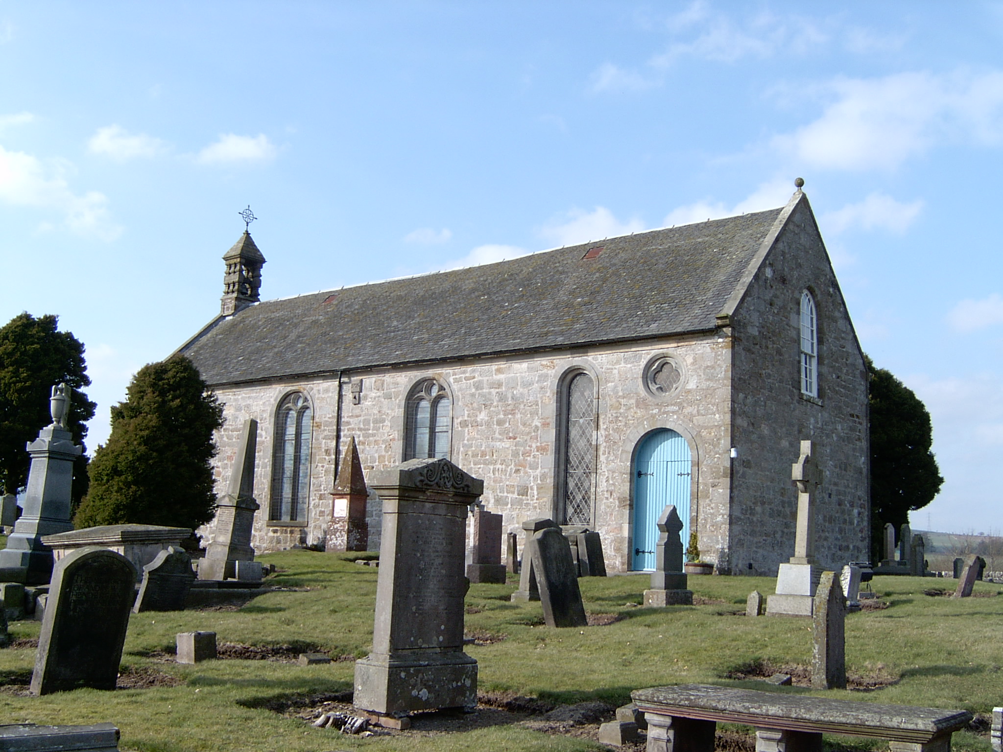
The original Orwell Kirk was on the north banks of Loch Leven. This church is now a ruin and the graveyard no longer tended. In 1729, a new church was built in the village of Milnathort. It is still in use today.
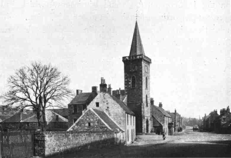
Compare with the old street view of Milnathort (photo circa 1900).
Record references;
- 463 Orwell (includes Milnathort) - Births 1688-1854
- 463 Orwell - Marriages 1693-1793
- 463 Orwell - Deaths 1783-1785
- Missing Records - Marriages 1736-1783
Other Church References for Orwell include at the National Records of Scotland ;
- Church Records - Ref "CH2 Church of Scotland, 551 Orwell" 12 Volumes - Kirk Session minutes 1681-1685, 1691-1787 and 1827-1908"
- Church Records - Ref "CH2 Church of Scotland, 551 Orwell" Accounts 1797-1865
- The transcription of the section for Orwell from the National Gazetteer (1868) provided by Colin Hinson.
- Ask for a calculation of the distance from Orwell to another place.
You can see maps centred on OS grid reference NO100064 (Lat/Lon: 56.241302, -3.453157), Orwell which are provided by:
- OpenStreetMap
- Google Maps
- StreetMap (Current Ordnance Survey maps)
- Bing (was Multimap)
- Old Maps Online
- National Library of Scotland (Old Ordnance Survey maps)
- Vision of Britain (Click "Historical units & statistics" for administrative areas.)
- Magic (Geographic information) (Click + on map if it doesn't show)
- GeoHack (Links to on-line maps and location specific services.)
- All places within the same township/parish shown on an Openstreetmap map.
- Nearby townships/parishes shown on an Openstreetmap map.
- Nearby places shown on an Openstreetmap map.