
Hide
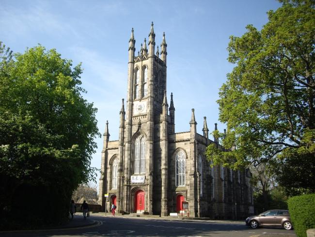
Holy Trinity, Edinburgh, Episcopal
hide
Hide
Hide
Holy Trinity,
Queensferry Road,
Edinburgh
Hide
It was founded in 1838. Shown on the 1849 OS Map as "Trinity Chapel", with seats for 900. By 1893, it was "Holy Trinity Church", with seats for 556.
By 1957 the church was closed and had been partially converted, internally, to an electricity sub-station. Externally, the appearance was unchanged.
Currently (2020) it is the Rhema Christian Centre.
It was located at NT2420074062 (Lat/Lon 55.953582, -3.215489). You can see this on maps provided by:
- OpenStreetMap
- Google Maps
- StreetMap (Current Ordnance Survey maps)
- Bing (was Multimap)
- Old Maps Online
- National Library of Scotland (Old Ordnance Survey maps)
- Vision of Britain (Click "Historical units & statistics" for administrative areas.)
- Magic (Geographic information) (Click + on map if it doesn't show)
- GeoHack (Links to on-line maps and location specific services.)