
Hide
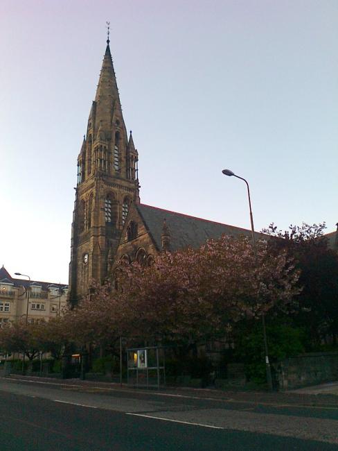
Mayfield Salisbury, Edinburgh, Church of Scotland
hide
Hide
Hide
Mayfield Salisbury,
West Mayfield,
Edinburgh
Hide
It was founded in 1879.
Originally Mayfield Free Church, then Mayfield United Free (1900), and Mayfield North after Union of the Churches (1929). Cost: ?8,000. Cruciform plan, Gothic style, 150-foot spire. Amalgamated with Fountainhall Road Church, 1958. Considerable reconstruction after fire, 1969. Extension containing office/meeting space and day care centre by Gray, Marshall & Associates, 1996-8.
It is located at NT2656971730 (Lat/Lon 55.933002, -3.176924). You can see this on maps provided by:
- OpenStreetMap
- Google Maps
- StreetMap (Current Ordnance Survey maps)
- Bing (was Multimap)
- Old Maps Online
- National Library of Scotland (Old Ordnance Survey maps)
- Vision of Britain (Click "Historical units & statistics" for administrative areas.)
- Magic (Geographic information) (Click + on map if it doesn't show)
- GeoHack (Links to on-line maps and location specific services.)