
Hide
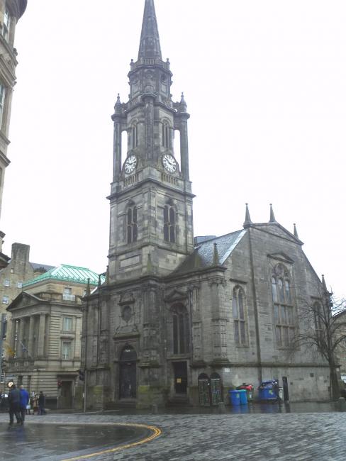
Tron Kirk, Edinburgh, Church of Scotland
hide
Hide
Hide
Tron Kirk,
High Street,
Edinburgh
High Street,
Edinburgh
Hide
It was founded in 1647. It closed in 1952.
Built by Town Council after St Giles was changed to Episcopal worship. Steeple added 1641. Modified in 1780s to allow building of North & South Bridges. Closed for worship in 1952, when the congregation "were transported to Moredun" (Birrell, 1980)
It was located at NT2591973635 (Lat/Lon 55.950015, -3.187849). You can see this on maps provided by:
- OpenStreetMap
- Google Maps
- StreetMap (Current Ordnance Survey maps)
- Bing (was Multimap)
- Old Maps Online
- National Library of Scotland (Old Ordnance Survey maps)
- Vision of Britain (Click "Historical units & statistics" for administrative areas.)
- Magic (Geographic information) (Click + on map if it doesn't show)
- GeoHack (Links to on-line maps and location specific services.)