
Hide
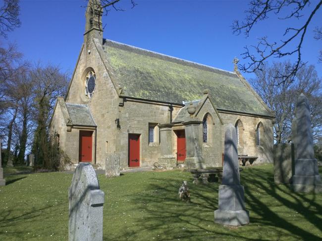
Fala and Soutra, Church of Scotland
hide
Hide
Hide
Church of Scotland,
Fala and Soutra
Hide
The parishes of Fala and Soutra joined in around 1589, with the congregation using Fala church.
Earlier history suggests a chapel in Soutra from around the 12th Century.
A brief history is available from Scotland's Churches Trust.
OPRs (Old Parish Registers) are available from 1673 (Births), 1675 (Marriages) and 1829 (Deaths), although the 17th Century part is damaged.
Details of the available records, gaps, etc can be found at the NRS.
It is located at NT4388260950 (Lat/Lon 55.83849, -2.897609). You can see this on maps provided by:
- OpenStreetMap
- Google Maps
- StreetMap (Current Ordnance Survey maps)
- Bing (was Multimap)
- Old Maps Online
- National Library of Scotland (Old Ordnance Survey maps)
- Vision of Britain (Click "Historical units & statistics" for administrative areas.)
- Magic (Geographic information) (Click + on map if it doesn't show)
- GeoHack (Links to on-line maps and location specific services.)
The first war memorial tablet is on the exterior of the church, the location of the second war tablet is unclear, but, is also available from the IWM.