Hide
Bothkennar Parish Church, Bothkennar, Church of Scotland
hide
Hide
Hide
Bothkennar Parish Church,
Bothkennar
Hide
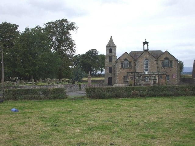
A meeting of the heritors of the parish of Bothkennar, held on 15th Feb. 1788, received a report from a mason and a wright on the extensive repairs needed for the then church. As the major heritors, on whom the greater part of any expense would fall, were not present, it was decided to postpone a decision. A meeting on July 25th 1788 agreed that a completely new church should be built on land to the east of the churchyard, if the owner of the land, Colonel Dundas, was willing to sell it. He was, and plans were drawn up and tenders received for a church to seat 500. After its completion, some of the heritors felt that a “spire or steeple” would be a good idea, and the meeting on 9th Aug. 1791 appointed a committee to consider where it should be positioned. On 25th Nov. 1791 “a meeting of the subscribers for building a spire or steeple” approved a plan for this “provided that it could be erected over the west Door of the Church so as to form a convenient Porch to the present west Door of the Church and that without running any risk of doing any injury to the present building”.
The position of the church “to the east of the churchyard”, and the “spire or steeple” over the west door, can be seen in the photograph.
- OpenStreetMap
- Google Maps
- StreetMap (Current Ordnance Survey maps)
- Bing (was Multimap)
- Old Maps Online
- National Library of Scotland (Old Ordnance Survey maps)
- Vision of Britain (Click "Historical units & statistics" for administrative areas.)
- Magic (Geographic information) (Click + on map if it doesn't show)
- GeoHack (Links to on-line maps and location specific services.)

