
Hide
Parish Maps from 'Historic Parishes of England and Wales - Boundaries before 1850'
hide
Hide
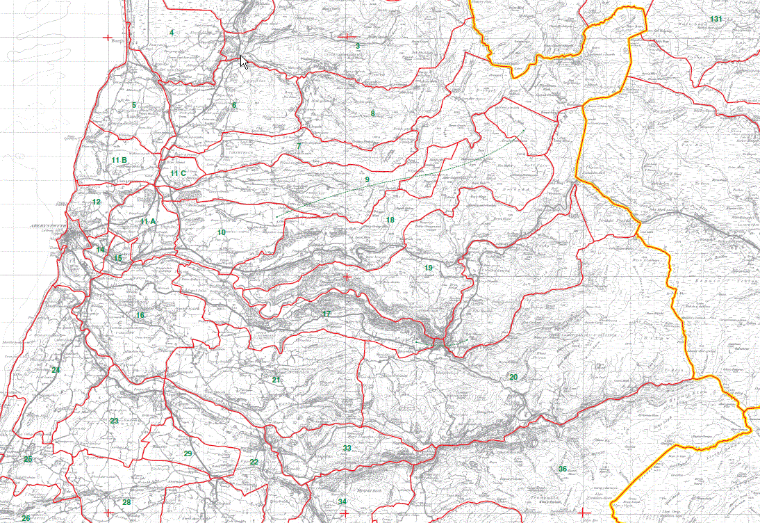
Elerch 8
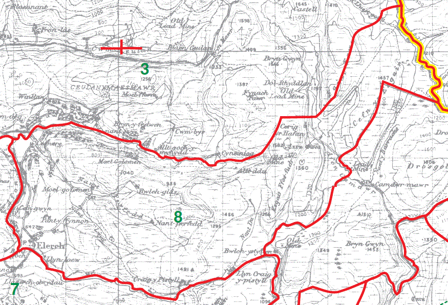
Trefeirig part 9
Parcel Canol part 10
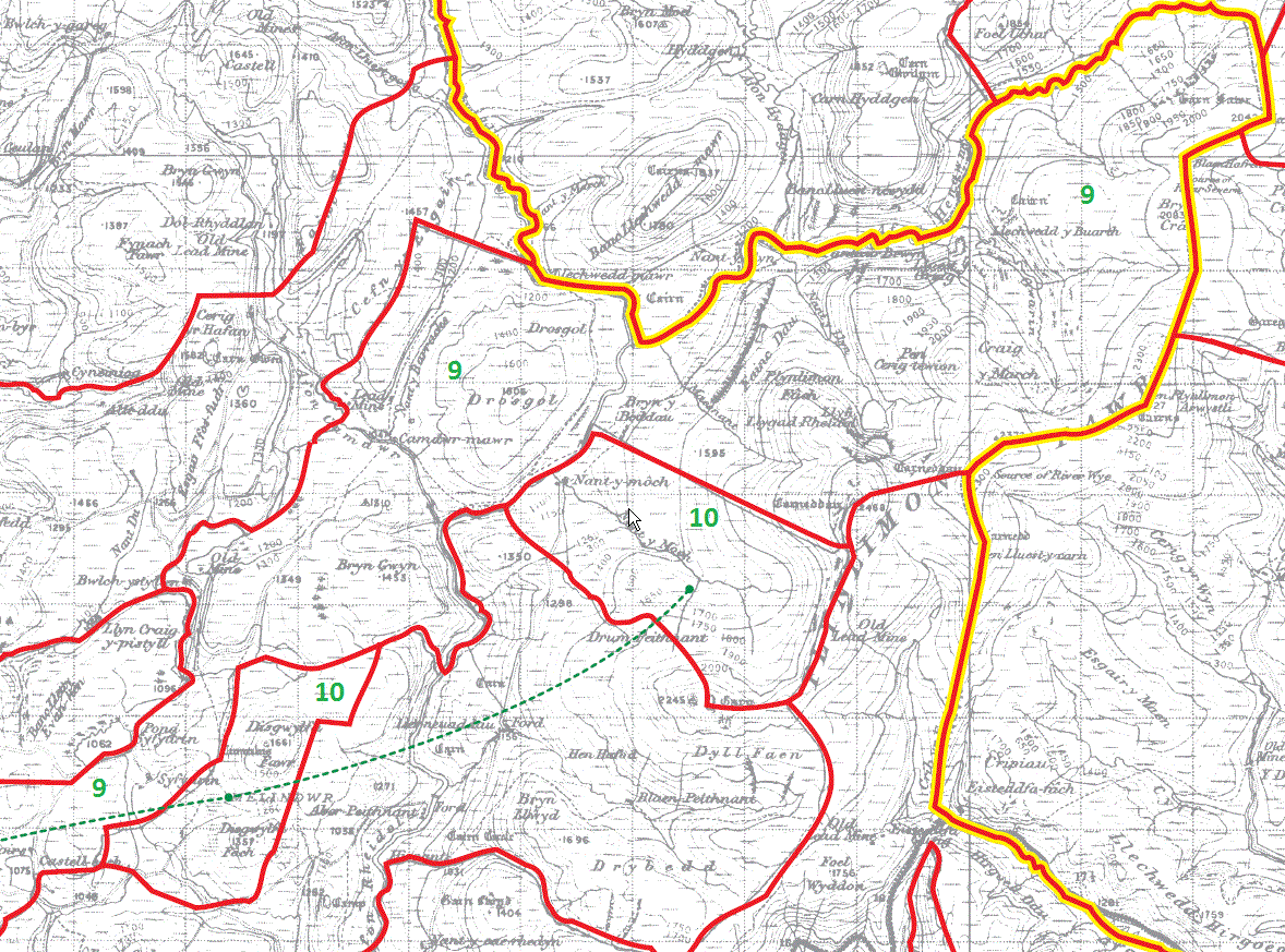
Trefeirig part 9
Parcel Canol part 10
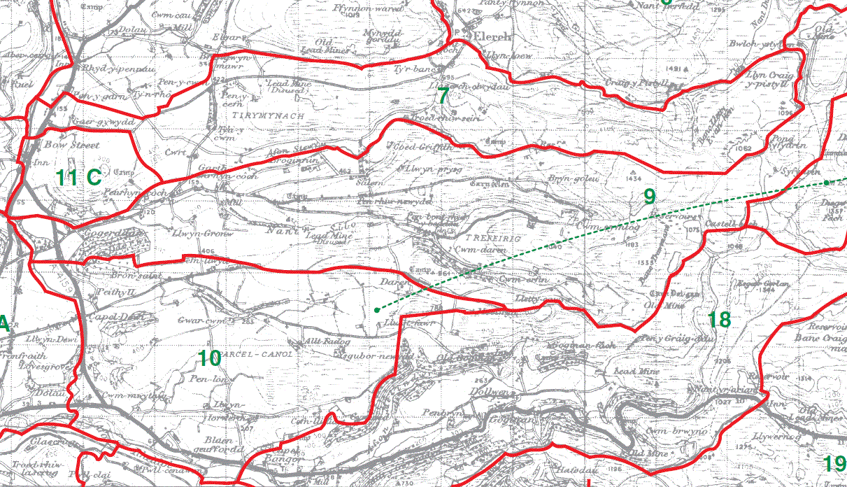
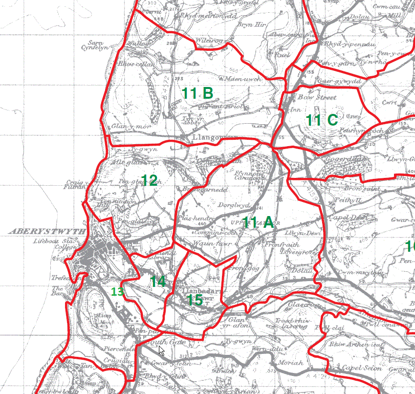
Upper Vaenor 11A
Claragh 11B
Broncastellan 11C
Lower Vaenor 12
Isan-dre 14
Uchan-dre 15
Aberystwyth town/chapelry 13
Lower Llanbadarn y Creuddyn 16

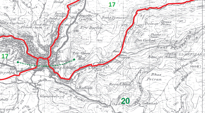
Upper Llanbadarn y Creuddyn part 17
Melindwr part 18
Cwmrheidol part 19

Upper Llanbadarn y Creuddyn part 17
Melindwr part 18
Cwmrheidol part 19
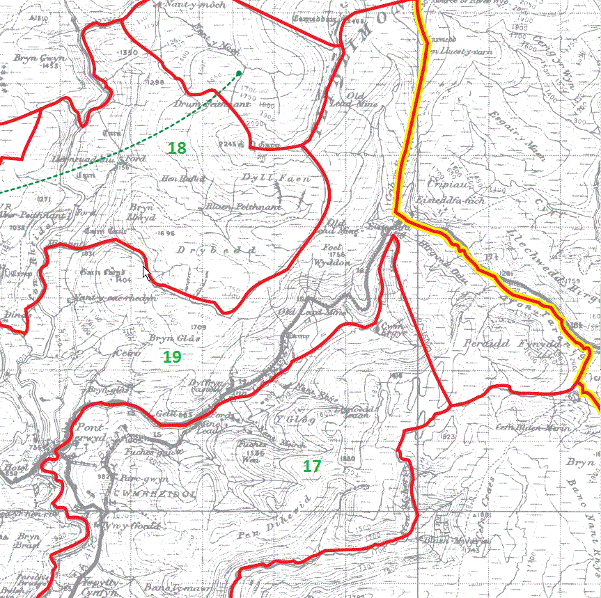
Upper Llanbadarn y Creuddyn part 17
Overview at reduced resolution
Key to green numbers shown on the map below - townships within Llanbadarn Fawr parish
- Elerch (8);
- Trefeirig (9);
- Parcel-canol (10);
- Upper Vaenor (11A);
- Claragh (11B);
- Broncastellan (11C);
- Lower Vaenor (12);
- Aberystwyth (13) [unmarked next to 14]
- Isan-dre (14);
- Uchan-dre (15);
- Lower Llanbadarn y Creuddyn (16);
- Upper Llanbadarn y Creuddyn (17);
- Melindwr (18);
- Cwmrheidol (19);
Use your browser to zoom in to see the details more clearly
This map is extracted from:
Kain, R.J.P., Oliver, R.R., Historic Parishes of England and Wales: an Electronic Map of Boundaries before 1850 with a Gazetteer and Metadata [computer file]. Colchester, Essex: History Data Service, UK Data Archive [distributor], 17 May 2001. SN: 4348.
Acknowledgement is made to R.J.P. Kain, R.R Oliver, the Economic and Social Research Council, the History Data Service and the UK Data Archive.