
Hide
Parish Maps from 'Historic Parishes of England and Wales - Boundaries before 1850'
hide
Hide
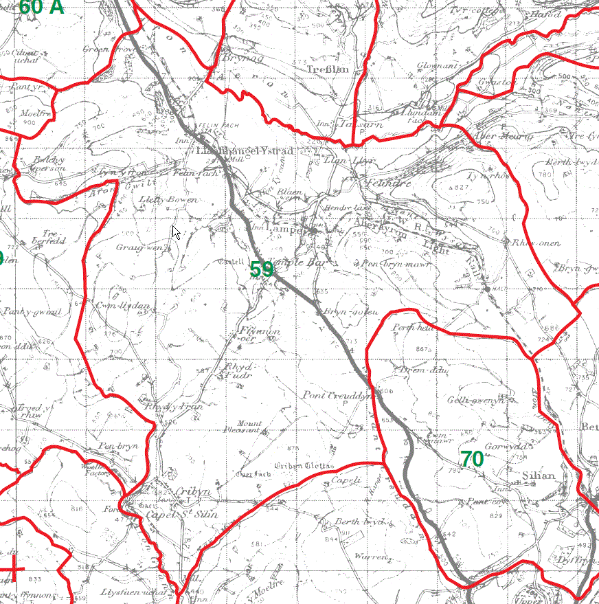
Llanfihangel Ystrad parish Map 59
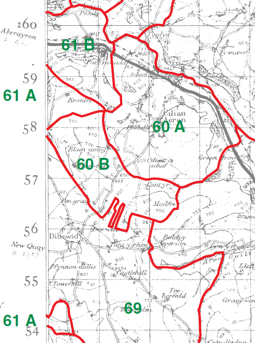
Ciliau Aeron Parish Map 60A & part 60B
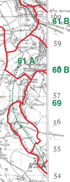
Llanerch-Aeron Parish Map part 61A & part 61B
|
|
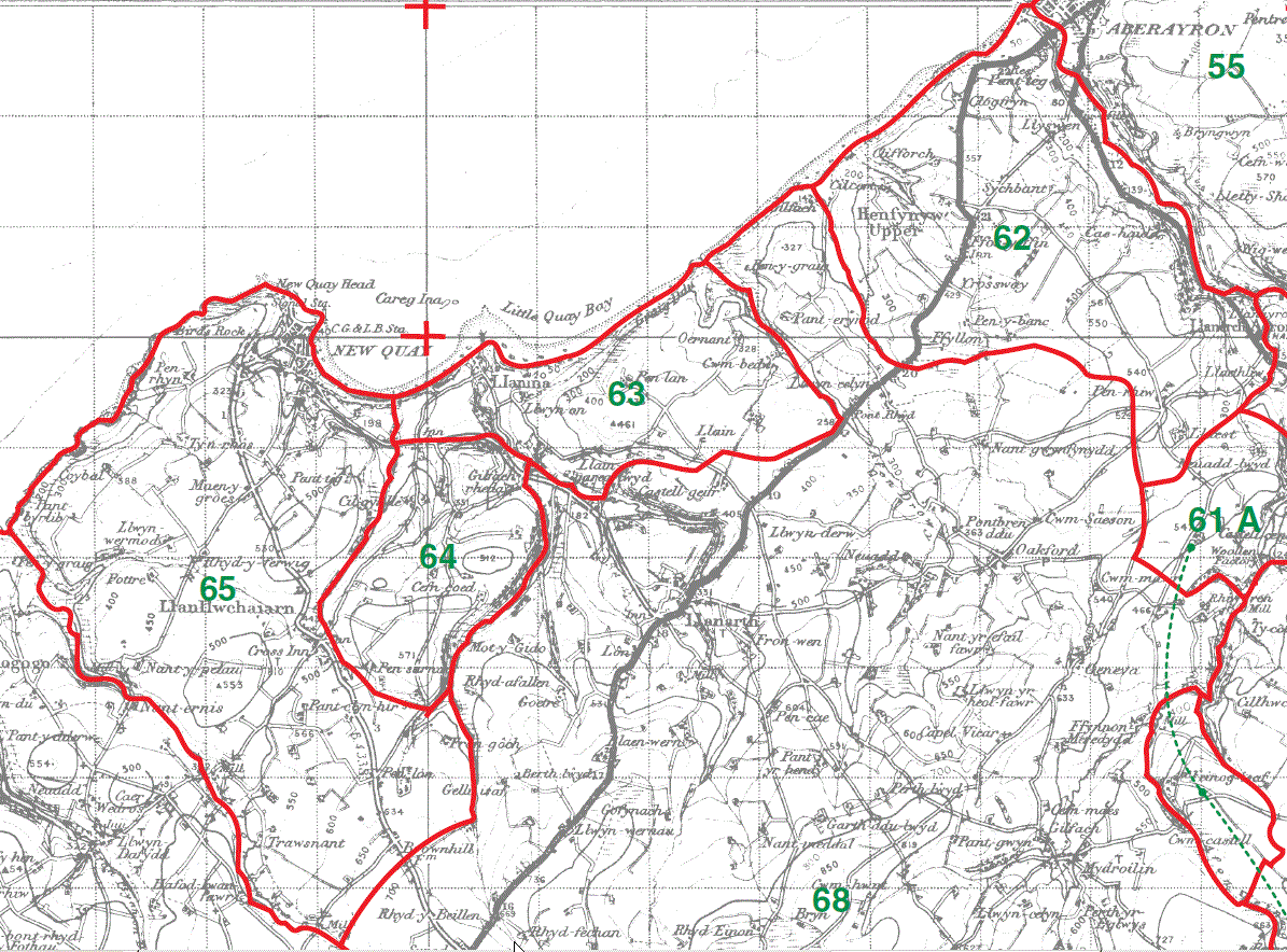
Henfynyw Parish Map 62
Llanina Parish Map 63 & 64
Llanllwchaiarn Parish Map 65
This map is extracted from:
Kain, R.J.P., Oliver, R.R., Historic Parishes of England and Wales: an Electronic Map of Boundaries before 1850 with a Gazetteer and Metadata [computer file]. Colchester, Essex: History Data Service, UK Data Archive [distributor], 17 May 2001. SN: 4348.
Acknowledgement is made to R.J.P. Kain, R.R Oliver, the Economic and Social Research Council, the History Data Service and the UK Data Archive.
[Gareth Hicks: 13 Dec 2012]