
Hide
Parish Maps from 'Historic Parishes of England and Wales - Boundaries before 1850'
hide
Hide
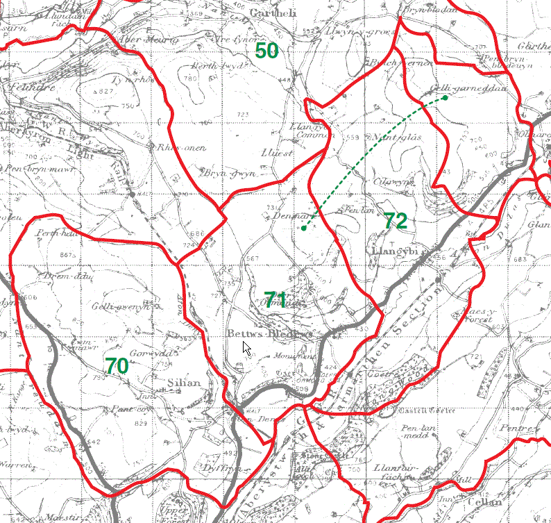
Silian Parish Map 70
Bettws Bledrws Parish Map 71
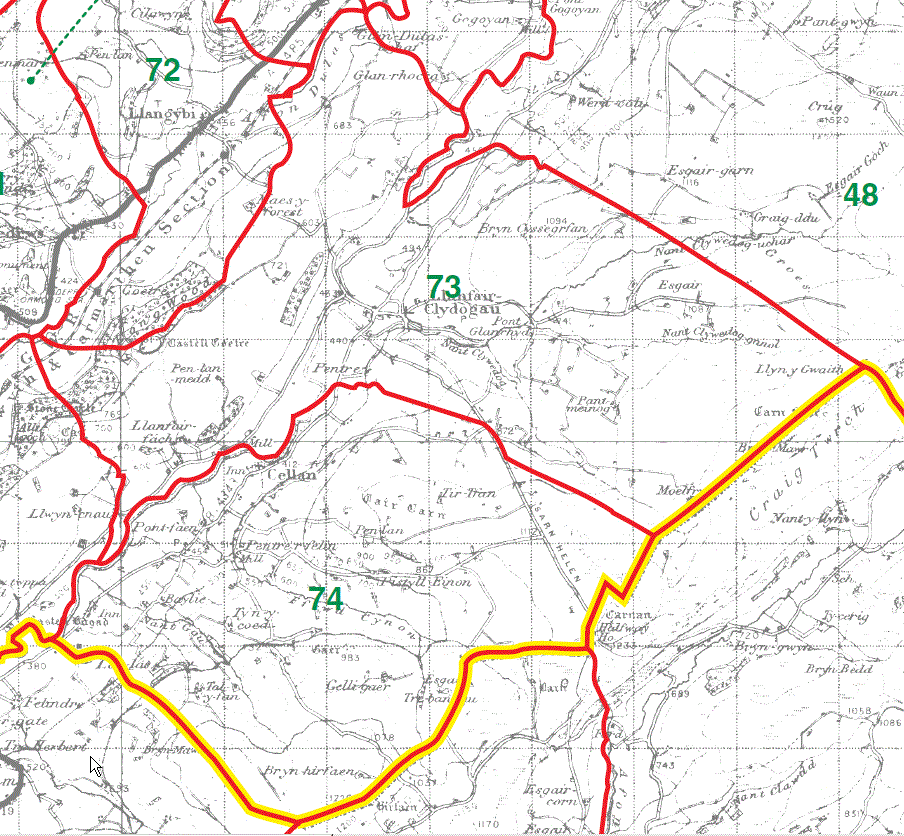
Llangybi Parish Map 72
Llanfair Clydogau Parish Map 73
Cellan Parish Map 74
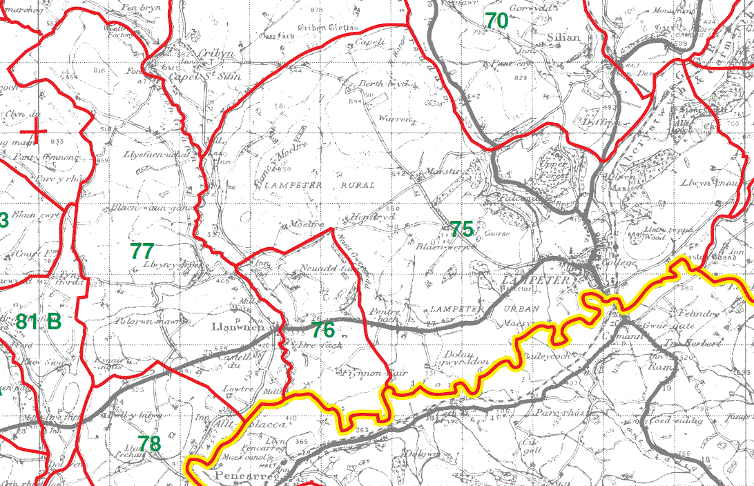
Lampeter Parish Map 75
Lampeter Parish Map (Tref-y-coed) 76
Llanwnen Parish Map 77
This map is extracted from:
Kain, R.J.P., Oliver, R.R., Historic Parishes of England and Wales: an Electronic Map of Boundaries before 1850 with a Gazetteer and Metadata [computer file]. Colchester, Essex: History Data Service, UK Data Archive [distributor], 17 May 2001. SN: 4348.
Acknowledgement is made to R.J.P. Kain, R.R Oliver, the Economic and Social Research Council, the History Data Service and the UK Data Archive.
[Gareth Hicks: 13 Dec 2012]