
Hide
Parish Maps from 'Historic Parishes of England and Wales - Boundaries before 1850'
hide
Hide
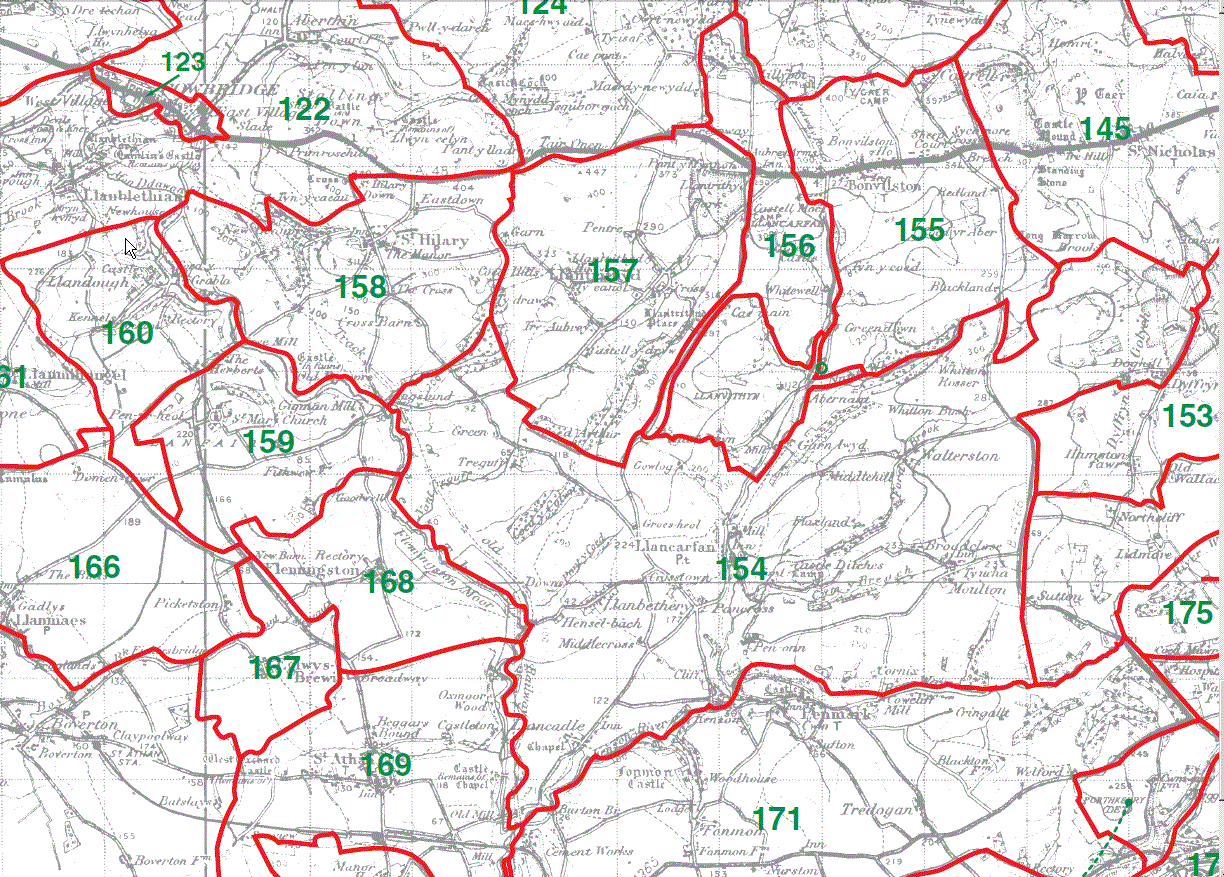
Llancarfan Parish Map 154
Bonvilston Parish Map 155
Llanvithin [Extra Parochial, inc with Llancarfan) 156
Llantrithyd Parish Map 157
St Hilary Parish Map 158
St Mary Church Parish Map 159
Llandough juxta CowbridgeParish Map 160
Eglwys Brewis Parish Map 167
Flemingston Parish Map168
This map is extracted from:
Kain, R.J.P., Oliver, R.R., Historic Parishes of England and Wales: an Electronic Map of Boundaries before 1850 with a Gazetteer and Metadata [computer file]. Colchester, Essex: History Data Service, UK Data Archive [distributor], 17 May 2001. SN: 4348.
Acknowledgement is made to R.J.P. Kain, R.R Oliver, the Economic and Social Research Council, the History Data Service and the UK Data Archive. [Last Updated : 27 Nov 2012 - Gareth Hicks]