
Hide
Parish Maps from 'Historic Parishes of England and Wales - Boundaries before 1850'
hide
Hide
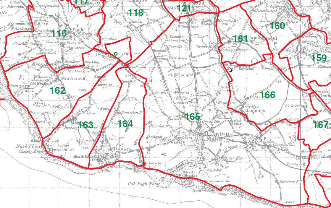
Llanmihangel Parish Map 161
Monknash Parish Map 162
Marcross Parish Map 163
St Donat's Parish Map 164
Llantwit Major Parish Map 165
Llanmaes Parish Map 166
This map is extracted from:
Kain, R.J.P., Oliver, R.R., Historic Parishes of England and Wales: an Electronic Map of Boundaries before 1850 with a Gazetteer and Metadata [computer file]. Colchester, Essex: History Data Service, UK Data Archive [distributor], 17 May 2001. SN: 4348.
Acknowledgement is made to R.J.P. Kain, R.R Oliver, the Economic and Social Research Council, the History Data Service and the UK Data Archive. [Last Updated : 27 Nov 2012 - Gareth Hicks]