
Hide
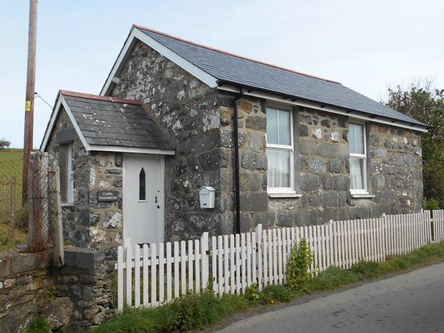
Nazareth Chapel, Rhoslefain (Independent)
hide
Hide
Hide
Nazareth Independent Chapel,
Rhoslefain,
Merionethshire
Hide
- The entry for this church on the National Monuments Record of Wales (NMRW) website (Coflein).
- By 1998 this chapel was no longer in use and has been converted into a private house.
It was located at SH5776005760 (Lat/Lon 52.630901, -4.103112). You can see this on maps provided by:
- OpenStreetMap
- Google Maps
- StreetMap (Current Ordnance Survey maps)
- OpenStreetMap Cymru (Welsh counties only)
- Bing (was Multimap)
- Old Maps Online
- National Library of Scotland (Old Ordnance Survey maps)
- Vision of Britain (Click "Historical units & statistics" for administrative areas.)
- Magic (Geographic information) (Click + on map if it doesn't show)
- GeoHack (Links to on-line maps and location specific services.)