
Hide
Parish Maps from 'Historic Parishes of England and Wales - Boundaries before 1850'
hide
Hide
Newport Parish Map 23
Dinas Parish Map 24
Llanllawer Parish Map 25
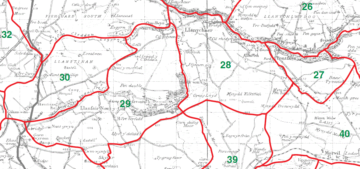
Llanychlwydog Parish Map 26

Pontfaen Parish Map 27
Llanychaer Parish Map 28
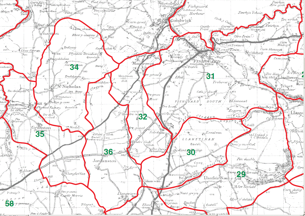
Llanfair-Nant-y-Gof Parish Map 29
Llanstinan Parish Map 30
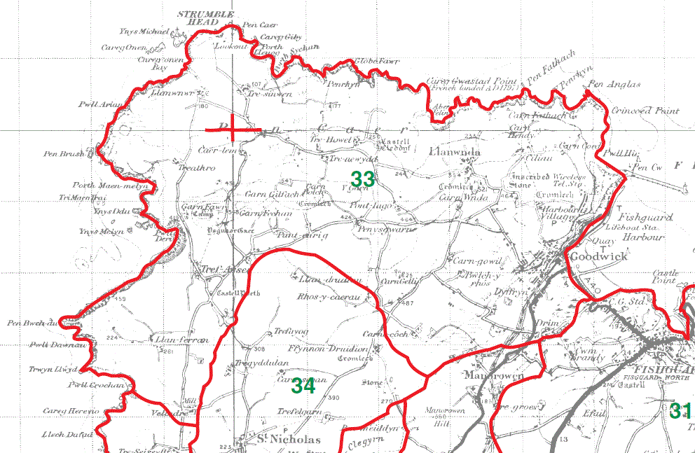
Fishguard Parish Map 31
Manorowen Parish Map 32
St Nicholas Parish Map 34
Granston Parish Map 35
Jordanston Parish Map 36
Llanwnda Parish Map 33
This map is extracted from:
Kain, R.J.P., Oliver, R.R., Historic Parishes of England and Wales: an Electronic Map of Boundaries before 1850 with a Gazetteer and Metadata [computer file]. Colchester, Essex: History Data Service, UK Data Archive [distributor], 17 May 2001. SN: 4348.
Acknowledgement is made to R.J.P. Kain, R.R Oliver, the Economic and Social Research Council, the History Data Service and the UK Data Archive.