
Hide
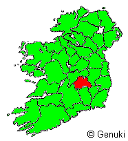
County Laois (Queens)
hide
Hide
hide
Hide
"Queen's County , a county of Ireland, bounded N and W by King's county, E by Kildare and part of Carlow, S by Kilkenny, and SW by Tipperary, 32 English m. long, and as many broad. Along the W boundary runs a range of high and steep mountains, and in the E the Dysart hills form a prominent and picturesque object. The lands have been thus distributed - Arable land, pasture, and meadow: 210,000 acres; Woods and plantations: 1,300 acres; Bog, mountain, and waste: 21,000 acres; Roads: 2,000 acres; Total area: 235,300 acres. Principle rivers, the Barrow and Nore. Chief towns, Maryborough, Portarlington, and Stradbelly. Almost every description of soil is found in this county, from a very stiff clay, to a light but fertile sandy loam. The principal mineral productions are coal and limestone. It sends 3 members to the British parliament. Pop. 90,000."
[From The New London Gazetteer (1826)]
"COUNTY LAOIS, or QUEEN'S COUNTY, an inland county in the province of Leinster, Ireland, is bounded N. by King's County, E. by county Kildare, a detached portion of King's County and county Carlow, S. by county Kilkenny, and W. by county Tipperary and King's County. It lies between 52° 45' and 53° 13' N. lat., 6° 54' and 7° 47' W. long. Its greatest length from E. to W. is 37 miles, and from N. to S. 33 miles. Its area is 664 square miles, or 424,854 statute acres; of which 342,422 acres are arable, 69,289 acres uncultivated, 11,630 acres in plantations, 1,117 acres in towns, and 396 acres under water. The population in 1841 was 153,930, in 1851 it was 111,623, and in 1861 it had fallen to 90,650, or 137 to every square mile of the entire surface-little more than half of the number in 1841, when there were 232 to every square mile. The number of persons from this county who emigrated from Irish ports, stating it was not their intention to return, from the 1st May, 1851, to the 31st December, 1864, was 23,442, or nearly 16 per cent. of the population at the former dates. The number of inhabited houses in 1861 was 16,768, and of uninhabited 533. The poor-law valuation in 1851 was £223,299, and the general valuation in 1861 was £257,249. ..... More "[Description from The National Gazetteer of Great Britain and Ireland (1868) Transcribed by Colin Hinson ©2018]
"COUNTY LAOIS, or QUEEN'S COUNTY, a county, of the province of LEINSTER, bounded on the east by the counties of Kildare and Carlow, on the north by the Kings county, on the west by the same and Tipperary county, and on the south by the counties of Kilkenny and Carlow. It extends from 52° 46' to 53° 10' (N Lat.), and from 6° 56' to 7° 48' (W. Lon.); and comprises an area, according to the Ordnance survey, of 396,810 statute acres, of which 335,838 are cultivated land, and 60,972 are unprofitable mountain and bog. The population, in 1821, amounted to 134,275; and in 1831, to 145,851. The slight notices of Ptolemy respecting the interior of Ireland lead to the inference that this county was inhabited by the Brigantes; but Whitaker asserts that the Scoti were the first settlers in it. Afterwards it was divided into Leix, which comprehended all that part of the county contained within the river Barrow to the north and east, the Nore to the south, and the Slieve- Bloom mountains to the west; and Ossory, which included the remainder. So early as the middle of the third century the latter of these divisions, with parts of the adjoining counties, was ranked as a kingdom, and annexed by Conary, King of Ireland, to his native dominion of Munster, instead of being, as formerly, attached to Leinster. Subsequent passages of history prove it to have been a district of considerable importance.....More" [Transcription from A Topographical Dictionary of Ireland - Samuel Lewis - 1837 Mel Lockie ©2013]
Hide
Laois County Library Local Studies; their collections include these books
- O’Hanlon’s History of the Queen’s County;
- Laois History and Society by Padraig G. Lane and William Nolan;
- Laois: an environmental history by John Feehan;
- The History of the Queen’s County by Daniel O’Byrne;
- The History and Antiquities of the Diocese of Ossory by William Carrigan;
- Queen’s County Survey by Charles Coote;
- The Laois Millennium by Patrick F. Meehan;
- Glimpses of Portlaoise by John O’Brien;
- Laois Lives edited by Teddy Fennelly.
- The O’Donovan Letters of the Queen’s County 1838 .
Laois (Queens) Cemetery Records - on IGP
Laois (Queen's) Headstone Photos - on IGP
County Laois Cemetery Records - on interment.net
Laois Censuses on IGP
- 1911 Census, Kilmanman Civil Parish, D.E.D. Castlecuff
- 1911 Census, Kilmanman Civil Parish, D.E.C. Clonaslee
The French Church - with a brief account of the Huguenots.
Laois (Queens) Church Records - on IGP
County Laois; Roman Catholic Records, list - on fianna
Laois (Queens) Vital Records (BMD) - on IGP
"The Grand canal, entering the county at Portarlington, runs 12 miles southwards, and joins the Barrow just below Athy in Kildare. A branch of the canal, about 12 miles long, communicates with Mountmellick. The Great Southern and Western railway crosses the county in a north-easterly direction, and connects it with Limerick, Kilkenny, and Cork on the S., and Dublin on the N. The roads are numerous and well laid out, and are generally kept in good order. " [Description from The National Gazetteer of Great Britain and Ireland (1868) Transcribed by Colin Hinson ©2018]
Laois Photos (places) - on IGP
County Laois - on wikipedia
Directory of Maryborough, 1824 - on IGP
The transcription for this county from the National Gazetteer (1868), provided by Colin Hinson.
The transcription for this county from the 1837 Lewis's Topographical Dictionary of Ireland [Mel Lockie ©2013]
The Ireland Genealogy Project's County Laois (Queens) page, and its listing of the Project's available Laois Records.
The Irish Ancestors website (subscription) has the following types of records: State Registration of Births, Marriages & Deaths, Census returns, Land records, Church records, Genealogical Office records, Gravestone inscriptions, Directories, Newspapers, Wills, Deeds, and Occupations.
Irish Ancestors' extensive County Laois (Queens) website.
The LDS FamilySearch Wiki's Ireland Online Genealogy Records.
The Fianna website's pages for County Laois (Queen's) provide important addresses and extensive information about online and other genealogy resources.
Roots Ireland (subscription) "offers access to a unique database of more than 20 million Irish records". Its Laois (Queens) coverage includes Baptismal/Birth Records, Marriage Records, Burial/Death Records, Gravestone Inscriptions, Griffith's Valuation (Free Access), and Census Substitutes.
Laois Photos (people) - on IGP
"It is divided for civil purposes into 11 baronies, Ballyadams, Clandonagh, Clarmallagh, Cullenagh, Maryborough, East and West, Portnahinch, Slievemargy, Stradbally, Tinnahinch, and Upperwoods, and containing 63 parishes. The chief towns are Maryborough, Mountmellick, Mountrath, Abbeyleix, and part of Portarlington, the rest of which is in King's County; also the market towns of Ballinakill, Durrow, and Stradbally."[Description from The National Gazetteer of Great Britain and Ireland (1868) Transcribed by Colin Hinson ©2018]
Laois civil parishes - on Irish Ancestors
See the county Laois page on logainm.ie which has links to its civil parish pages
"The Placenames Database of Ireland was created by Fiontar & Scoil na Gaeilge in collaboration with The Placenames Branch (Department of Culture, Heritage and the Gaeltacht). This is a comprehensive management system for data, archival records and placenames research conducted by the State. It is a public resource for Irish people at home and abroad, and for all those who appreciate the rich heritage of Irish placenames."
Oaths of Allegiance 1775 - Laois - on IGP
Alphabetical List of Landowners in 1870's - Names & Addresses Only - on IGP
Laois (Queens) Land Records - on IGP
Griffiths Valuation 1847/64 on the Ask about Ireland site. Use the search box to bring up entries showing Barony/Parish/Townlands and lists of Occupants
Tithe Applotment Books for county Laois and its parishes are available online on the National Archives of Ireland website (free).
- The Tithe Applotment Books were compiled between 1823 and 1838 as a survey of land in each civil parish to determine the payment of tithes (a religious tax). Unlike Griffith's Valuation they do not cover cities or towns.
Laois (Queens) Military & Constabulary Records (Irish Constabulary with native county of Queens) - on IGP
Laois (Queen's) Headstone Photos - on IGP
Surnames found County Queen's Co. - 1100 thru 1600 - on IGP
Laois Newspaper Extracts - on IGP
- Dublin Evening Post March 12, 1801, Queen's County
- LAOIS, Freeman's Journal 16 July 1860
- LAOIS, Sep 25 1887, The Times
- LAOIS, Dublin Journal, 12 Oct 1745
Newspapers held in Laois County Library Local Studies Department
- The Leinster Express 1831 – 2001 on microfilm and hardcopies from 2002 to the present;
- The Nationalist 1883 – 2004 on microfilm and hardcopies from 2005 to the present;
- Some copies of the Leinster Independent on microfilm.
- The Leinster Express from 1831-1949 is now available online in all public libraries in Laois. The paper has been digitised and is searchable via The Irish Newspaper Archives.
"One of the seven coalfields in Ireland commences in the Slievemargue Hills, and extends into Kilkenny and Carlow, and is extensively worked. The coal, which is of the anthracite quality, and unsuited for domestic purposes, is purchased by the maltsters and distillers of Kilkenny and the neighbourhood. Iron ore, copper, and manganese exist in small quantities, but are not worked. Potters' clay is found, and made into tiles, crocks, and other coarse earthenware. Slate and (in some places) marble are quarried; and near Mountmellick is found sandstone of soft texture, which is used for chimney-pieces and hearthstones.
The climate is dry and salubrious. The occupations of the population are almost wholly agricultural. The soil is generally fertile, but in some parts, especially towards the N., it is light and unproductive, though capable of improvement. In the Slieve Bloom mountains, a yellow clay, and, in some parts, a strong red clay, produce good crows of oats and potatoes, but are often wet and spongy as well as rocky. The Dysart hills, and the plain from which they rise, consist of rich loam, and are good grazing grounds; and the lands on either side of the Barrow are rich and alluvial, and specially suited for pasturage. Bogs are to be found in many places, especially about Maryborough, and afford a valuable supply of turf for fuel or for manure.
Pasturage predominates over tillage. In 1865 there were 148,391 acres under crop, of which 5,966 acres were devoted to wheat, 23,414 acres to bats, 22,905 to barley, bere, rye, vetches, and rape, 21,105 acres to potatoes, 15,987 to turnips, mangel-wurzel, beetroot, carrots, and other green crops, 422 acres to flair, and 68,593 to meadow and clover. 359 acres were left fallow or uncultivated, and 214,132 acres were under grazing land.
Upon the several holdings there were 12,822 horses, 65,785 cattle, 97,132 sheep, and 29,818 pigs.
The acreage under wheat in 1865 was not one-fourth of that in 1848, when 24,944 acres were sown, since which time the quantity gradually decreased, except during and immediately succeeding the Crimean war, when there was a temporary reaction. The large importations of foreign grain in later years will account for this change. The extent under oats in 1848 was 32,941 acres, or more than 40 per cent. over that of 1865, while that of barley, here, &c., was only 6,881 acres. That under turnips and other green crop increased from 10,262 acres in 1848 to 15,987 acres in 1865. Flax is still little grown, and only for domestic consumption.
The cattle are generally of a very superior description, and have increased in numbers from 50,753 in 1848, the number of pigs increased from 16,571 in the same year, while sheep gradually declined from 198,208 in the same year to less than half that number in 1865. The value of live stock generally increased from £571,390 in 1851 to £661,611 in 1861.
The woollen trade was formerly carried on to a considerable extent, and broadcloths were manufactured at Maryborough and Mountmellick, but the business is now very limited, and is confined to flannels, friezes, and coarse stuffs. There is also something done in weaving of linen and cotton"
[Description from The National Gazetteer of Great Britain and Ireland (1868) Transcribed by Colin Hinson ©2018]
A LIST OF SUBSCRIPTIONS IN AID OF THE POOR RELIEF FUND OF THE PARISH OF CASTLETOWN, QUEEN’S COUNTY. 1847 - on IGP
Laois (Queens) Wills - on IGP
"The religion of the county is principally Roman Catholic, 80,025 persons, or 88 per cent., having in 1861 belonged to that persuasion; 9,683, or 11 per cent., were members of the Established Church, and 942, or 1 per cent., were of other Christian denominations." [Description from The National Gazetteer of Great Britain and Ireland (1868) Transcribed by Colin Hinson ©2018]
"In 1861 there were 83 National schools within the county, besides 39 under the Church Education Society and other societies, and 14 private schools, in which a course of primary instruction was imparted, and there were 19 other schools in which one or more foreign languages were taught. The standard of education has been steadily raised since 1841, when only 33 per cent. of the population over five years of age could read and write, 26 per cent. could read only, and 41 per cent. could neither read nor write. The per-centage in 1851 of those who could read and write had increased to 37, and that of persons who could read only, and who could neither read nor write, had fallen to 25 and 38 respectively. In 1861 46 per cent. of those above five years of age could read and write, 23 per cent. could read only, and the per-centage of persons wholly ignorant had fallen to 31" [Description from The National Gazetteer of Great Britain and Ireland (1868) Transcribed by Colin Hinson ©2018]