
Hide
St John The Evangelist, Macclesfield, Church of England
hide
Hide
Hide
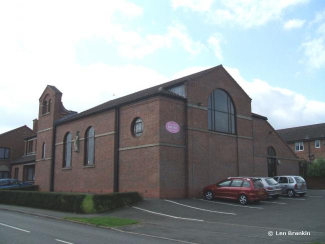
St John The Evangelist,
Wilwick Lane,
Macclesfield
Hide
Statham Street.
Church History
Founded in 1873 as a chapel to Macclesfield: St. Michael & All Angels, at the corner of Statham Street and Dale Street (now St. John's Road). In 1888 it became a district church for part of the township of Macclesfield (previously served by Macclesfield: St. Michael & All Angels). The boundaries of "The District Chapelry of Saint John the Evangelist, Macclesfield" were described in the London Gazette on 8 May 1888:
"All that part of the new parish (sometime district chapelry) of Macclesfield in the county of Chester and in the diocese of Chester which is bounded upon the south-west by the parish of Gawsworth, upon the south by the new parish of Saint James Higher Sutton, upon the east partly by the new parish of Sutton and partly by the new parish of Saint Paul Macclesfield all the said abutting cures being in the county and diocese aforesaid, and upon the remaining sides that is to say upon the north and upon the west, by an imaginary line commencing upon the boundary which divides the said new parish of Saint Paul Macclesfield from the new parish of Macclesfield aforesaid at the centre of the foot bridge over the River Boiling, which bridge connects Lower Bank-street with the footway which passes along the north-eastern side of Park Green and extending thence north-westward to and along the middle of the said footway for a distance of twelve chains or thereabouts to its junction at the north-western end of Park Green aforesaid, wi th Millstreet, and continuing thence still north- westward along the middle of the footway which passes along the north-eastern side of the last-named street for a distance of two chains or thereabouts to its junction with Duke-street and extending thence south-westward along the middle of the last-named street for a distance of one and a half chains or thereabouts to its junction with Samuel-street, and continuing thence south-westward along the middle of the last-named street for a distance of five chains or thereabouts to its junction with Elizabeth-street, and extending thence north-west ward along the middle of the last-named street for a distance of six chains or thereabouts to its junction with Crossall-street and extending thence first south-westward and then westward along the middle of the last-named street for a distance of sixteen chains or thereabouts to its junction with Bond-street, and extending thence southward along the middle of the last-named street for a distance of seventeen chains or thereabouts to its junction with Park-lane and extending thence south-westward along the middle of the said lane for a distance of twenty-seven chains or thereabouts to its junction with Oxford-road and with Congleton-road and extending thence first southward and then south-westward along the middle of the last-named road for a distance of thirty-one and a half chains or thereabouts to the boundary which divides the said new parish of Macclesfield from the parish of Gawsworth aforesaid."
In the early 1960s the church moved to its present site some distance away on the corner of Earlsway and Wilwick Lane
The district was affected by the following boundary changes:
- 1962 January 25 — (details not available)
- 1963 April 11 — boundary change with Macclesfield: St. Michael & All Angels (details not available)
Church Records
C = Christenings (Baptisms) ; M = Marriages ; B = Burials ; BTs = Bishop's Transcripts
| Original Registers | C 1873-2013 ; M 1888-2007 — Cheshire Archives (P 192) C from 2013 ; M from 2007 — Church |
| Microfilm Copies | C 1873-1929 ; M 1888-1914 — Cheshire Archives ; Family History Society of Cheshire ; Macclesfield Library |
| Copies and Indexes | M 1888-2007 — Cheshire BMD (CE:1055) |
| Notes | B — none |
- OpenStreetMap
- Google Maps
- StreetMap (Current Ordnance Survey maps)
- Bing (was Multimap)
- Old Maps Online
- National Library of Scotland (Old Ordnance Survey maps)
- Vision of Britain (Click "Historical units & statistics" for administrative areas.)
- English Jurisdictions in 1851 (Unfortunately the LDS have removed the facility to enable us to specify a starting location, you will need to search yourself on their map.)
- Magic (Geographic information) (Click + on map if it doesn't show)
- GeoHack (Links to on-line maps and location specific services.)