
Hide
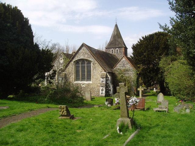
St Paulinus, St Pauls Cray, Church of England
hide
Hide
© Copyright Dr Neil Clifton and licensed for reuse under this Creative Commons Licence
Hide
St Paulinus,
Main Road,
St Pauls Cray
Hide
It was founded in 11th C. It closed before 1980 as a mainstream Anglican church. The building is now occupied by the "Redeemed Christian Church of God" movement and renamed as "His Royal Majesty House".
It was located at TQ4739569080 (Lat/Lon 51.401604, 0.117551). You can see this on maps provided by:
- OpenStreetMap
- Google Maps
- StreetMap (Current Ordnance Survey maps)
- Bing (was Multimap)
- Old Maps Online
- National Library of Scotland (Old Ordnance Survey maps)
- Vision of Britain (Click "Historical units & statistics" for administrative areas.)
- English Jurisdictions in 1851 (Unfortunately the LDS have removed the facility to enable us to specify a starting location, you will need to search yourself on their map.)
- Magic (Geographic information) (Click + on map if it doesn't show)
- GeoHack (Links to on-line maps and location specific services.)