
Hide
Chorlton on Medlock
hide
Hide
hide
Hide
hide
Hide
Hide
"CHORLTON-UPON-MEDLOCK, a township, five chapelries, and a sub-district in Chorlton district, Manchester parish, Lancashire. The township lies within Manchester borough, and includes the south-eastern part of Manchester city. Acres, 700. Real property, £178,750. Pop., in 1841, 28,336; in 1861, 44,795. Houses, 8,584. The chapelries are All Saints, St. Luke, St. Saviour, St. Stephen, and St. Paul, and all are rectories in the diocese of Manchester. Value of All Saints, £488; of St. Luke, £300;* of St. Saviour, £543;* of St. Stephen, £356;* of St. Paul, £248.* Patrons of All Saints, the Representatives of the Rev. Dr. Burton; of St. Luke, the Repr. of R. Gardner, Esq.; of St. Saviour, the Rev. E. Birch; of St. Stephen and St. Paul, Trustees. All Saints church was built in 1820, and has a tower and dome. St. Luke's was built in 1865, and is in the decorated English style. St. Paul's was built in 1862, and is in the later English style. An Armenian church, the earliest in England, was founded in Sept., 1869. A free library was built in 1866, at a cost of £4,000; and had 6,000 volumes at its opening. A medical hospital was built in 1865. Land for a public park was purchased in 1868. The sub-d. is contaminate with the township."
John Marius Wilson, Imperial Gazetteer of England and Wales (1870-72)
Hide
Local studies information is held at Manchester central library.
Details about the census records, and indexes for Chorlton on Medlock.
The Register Office covering the Chorlton on Medlock area is Manchester.
The National Gazetteer of Great Britain and Ireland - 1868
"CHORLTON-ON-MEDLOCK, a township in the parish and borough of Manchester, in the county of Lancaster. See Manchester."
- Ask for a calculation of the distance from Chorlton on Medlock to another place.
In 1835 Chorlton on Medlock was a township in the parish of Manchester.
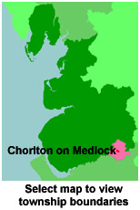
View maps of Chorlton on Medlock and places within its boundaries.
View a map of the boundaries of this town/parish.
You can see maps centred on OS grid reference SJ851967 (Lat/Lon: 53.466635, -2.225225), Chorlton on Medlock which are provided by:
- OpenStreetMap
- Google Maps
- StreetMap (Current Ordnance Survey maps)
- Bing (was Multimap)
- Old Maps Online
- National Library of Scotland (Old Ordnance Survey maps)
- Vision of Britain (Click "Historical units & statistics" for administrative areas.)
- English Jurisdictions in 1851 (Unfortunately the LDS have removed the facility to enable us to specify a starting location, you will need to search yourself on their map.)
- Magic (Geographic information) (Click + on map if it doesn't show)
- GeoHack (Links to on-line maps and location specific services.)
- All places within the same township/parish shown on an Openstreetmap map.
- Nearby townships/parishes shown on an Openstreetmap map.
- Nearby places shown on an Openstreetmap map.
The Workhouse site has an interesting description of Chorlton workhouse.
For probate purposes prior to 1858, Chorlton on Medlock was in the Archdeaconry of Chester, in the Diocese of Chester. The original Lancashire wills for the Archdeaconry of Chester are held at the Lancashire Record Office.
You can also see Family History Societies covering the nearby area, plotted on a map. This facility is being developed, and is awaiting societies to enter information about the places they cover.