
Hide
Halton
hide
Hide
hide
Hide
hide
Hide
Hide
HALTON, a village and a parish in Lancaster district, Lancashire. The village stands on the river Lune, and on the Lancaster and Leeds railway, 2½ miles NNE of Lancaster; and has a station on the railway, and a post office under Lancaster. The parish includes also the chapelry of Aughton. Acres, 3,738. Real property, £1,520. Pop., 670. Houses, 130. The property is much subdivided. Halton Hall is a chief residence. Coins of Canute, now in the British museum, were found, in 1815, on Halton moor; vestiges of a Roman camp and an ancient barrow are near the church; and remains of a Roman altar were found at the camp. The living is a rectory in the diocese of Manchester. Value, £479. Patron, J. Hastings, Esq. The church is modern, with an ancient tower; and has a memorial font. The p. curacy of Aughton is a separate benefice. An endowed school has £15; and other charities have £68.
John Marius Wilson, Imperial Gazetteer of England and Wales (1870-72)
Hide
Details about the census records, and indexes for Halton.
| High Road Congregational, Halton |
| Foundry Lane, Cemetery, Halton |
| St Robert Bellarmine Roman Catholic, Halton |
The Register Office covering the Halton area is Lancaster.
The National Gazetteer of Great Britain and Ireland - 1868
"HALTON, a parish in the hundred of Lonsdale South of the Sands, county Lancaster, 3 miles N.E. of Lancaster. It is situated on the N. bank of the river Lune, and includes the chapelry of Aughton. The village is small, and the inhabitants chiefly engaged in agriculture. The tithes have been commuted for a rent-charge of £480. The living is a rectory in the diocese of Manchester, value £479. The church is ancient. The parochial charities consist of a bequest by Thomas Withers in 1747, for the purposes of education, now producing £15 per annum. R. F. Bradshaw, Esq., is lord of the manor, and chief landowner."
"AUGHTON, a chapelry in the parish of Halton, and hundred of Lonsdale, in the county palatine of Lancaster, 6 miles to the N.E. of Lancaster, its post town. It lies on the banks of the river Lune. The living is a perpetual curacy in the diocese of Manchester, value £140, in the patronage of the rector of Halton. There are some charitable endowments, the annual income of which is £18."
John Marius Wilson, Imperial Gazetteer of England and Wales - 1870-2
- Ask for a calculation of the distance from Halton to another place.
Information about boundaries and administrative areas is available from A Vision of Britain through time.
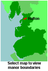
View a map of the boundaries of this town/parish.
You can see maps centred on OS grid reference SD522664 (Lat/Lon: 54.091422, -2.73243), Halton which are provided by:
- OpenStreetMap
- Google Maps
- StreetMap (Current Ordnance Survey maps)
- Bing (was Multimap)
- Old Maps Online
- National Library of Scotland (Old Ordnance Survey maps)
- Vision of Britain (Click "Historical units & statistics" for administrative areas.)
- English Jurisdictions in 1851 (Unfortunately the LDS have removed the facility to enable us to specify a starting location, you will need to search yourself on their map.)
- Magic (Geographic information) (Click + on map if it doesn't show)
- GeoHack (Links to on-line maps and location specific services.)
- All places within the same township/parish shown on an Openstreetmap map.
- Nearby townships/parishes shown on an Openstreetmap map.
- Nearby places shown on an Openstreetmap map.
For probate purposes prior to 1858, Halton was in the Peculiar of the Manor of Halton. The records of the Peculiar of Halton are held at the Lancashire Record Office.
You can also see Family History Societies covering the nearby area, plotted on a map. This facility is being developed, and is awaiting societies to enter information about the places they cover.