
Hide
Pleasington
hide
Hide
hide
Hide
hide
Hide
Hide
PLEASINGTON, a township in Blackburn parish, Lancashire; on the river Darwen, and on the East Lancashire railway, 3 miles W by S of Blackburn. It has a station on the railway ; a Roman Catholic chapel, built in 1819, at a cost of more than £20,000; and an endowed school, with £10 a year. Acres, 1,600. Real property, £3,414; of which £155 are in quarries. The manor, with P. Hall, belongs to J. B. Bowden, Esq. P. Hall is a modern mansion in the Grecian style. P. Old Hall was built in 1587, and was a fine mansion, but is now a farm-house. Feniscowles Hall is the seat of Sir W. H. Feilden, Bart.
John Marius Wilson, Imperial Gazetteer of England and Wales (1870-72)
Hide
Local studies information is held at Blackburn library.
| St Mary and St John the Baptist, Pleasington, Roman Catholic |
Details about the census records, and indexes for Pleasington.
| St Mary and St John the Baptist, Pleasington, Roman Catholic |
The Register Office covering the Pleasington area is Blackburn.
The National Gazetteer of Great Britain and Ireland - 1868
"PLEASINGTON, a township in the parish of Blackburn, lower division of the hundred of Blackburn, county Lancaster, 2½ miles S.W. of Blackburn. It is a station on the Lancashire and Yorkshire railway. The village, which is of small extent and irregularly built, is situated on a height. The inhabitants are wholly engaged in agriculture. There is a Roman Catholic chapel, called Pleasington Priory, and dedicated to SS. Mary and John; it was erected at an outlay of £20,000, defrayed by the late John Francis Butler, Esq., and was opened in 1819. There is an endowed free school. Pleasington Hall and Feniscowles Hall are the principal residences. J. B. Bowden, Esq., is lord of the manor."
- Ask for a calculation of the distance from Pleasington to another place.
In 1835 Pleasington was a township in the parish of Blackburn.
View maps of Pleasington and places within its boundaries.
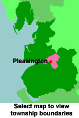
View a map of the boundaries of this town/parish.
You can see maps centred on OS grid reference SD642274 (Lat/Lon: 53.741588, -2.544005), Pleasington which are provided by:
- OpenStreetMap
- Google Maps
- StreetMap (Current Ordnance Survey maps)
- Bing (was Multimap)
- Old Maps Online
- National Library of Scotland (Old Ordnance Survey maps)
- Vision of Britain (Click "Historical units & statistics" for administrative areas.)
- English Jurisdictions in 1851 (Unfortunately the LDS have removed the facility to enable us to specify a starting location, you will need to search yourself on their map.)
- Magic (Geographic information) (Click + on map if it doesn't show)
- GeoHack (Links to on-line maps and location specific services.)
- All places within the same township/parish shown on an Openstreetmap map.
- Nearby townships/parishes shown on an Openstreetmap map.
- Nearby places shown on an Openstreetmap map.
For probate purposes prior to 1858, Pleasington was in the Archdeaconry of Chester, in the Diocese of Chester. The original Lancashire wills for the Archdeaconry of Chester are held at the Lancashire Record Office.
You can also see Family History Societies covering the nearby area, plotted on a map. This facility is being developed, and is awaiting societies to enter information about the places they cover.