
Hide
Rainford
hide
Hide
hide
Hide
hide
Hide
Hide
RAINFORD, a village, a township-chapelry, and a sub-district, in Prescot parish and district, Lancashire. The village stands on the Ormskirk and St. Helens railway, 1 mile S S E of that railway 's intersection by the Liverpool and Wigan railway, and 4¼ miles N W by N of St. Helens; and has a station on the railway, and a post-office under St. Helens. The chapelry comprises 5,803 acres. Real property, £12,623; of which £3,280 are in mines. Pop. in 1851, 2,333; in 1861, 2,784. Houses, 478. The increase of pop. arose from the opening of new collieries. The property is divided among a few. The manor belongs to the Earl of Derby. R. Hall, Mount Pleasant, and the Rookery are chief residences. Much of the land is reclaimed morass. Tobacco-pipemaking is largely carried on. The living is a p. curacy in the diocese of Chester. Value, £135.* Patron, the Vicar of Prescot. The church is a plain building, with a belfry. There are an Independent chapel, an endowed school for boys, and a national school for girls. The sub-district is conterminate with the chapelry.
John Marius Wilson, Imperial Gazetteer of England and Wales (1870-72)
Hide
Local studies information is held at St.Helens library.
| Higher Lane, Independent, Rainford |
Details about the census records, and indexes for Rainford.
| Higher Lane, Independent, Rainford |
| Corpus Christi, Rainford, Roman Catholic |
The registers of the parish church, All Saints, have been published by the Lancashire Parish Register Society as follows.
- Volume 119 - Mar 1704-1812, Bap & Bur 1702-1812.
The Register Office covering the Rainford area is St Helens.
The National Gazetteer of Great Britain and Ireland - 1868
"RAINFORD, a chapelry in the parish of Prescot, hundred of West Derby, county Lancaster, 6 miles N.E. of Prescot, its post town, and 4½ from St. Helen's. It is a station on the W. section of the Lancashire and Yorkshire railway. A considerable portion of the land now drained was formerly a morass. There are tobacco-pipe and crucible manufactories. The village is considerable. The living is a perpetual curacy in the diocese of Chester, value £135, in the patronage of the Vicar of Prescot. The church, which was built as a chapel-of-ease to Prescot, is an ancient edifice. The charities produce about £30 per annum, which goes towards the support of a school."
- Ask for a calculation of the distance from Rainford to another place.
In 1835 Rainford was a township in the parish of Prescot.
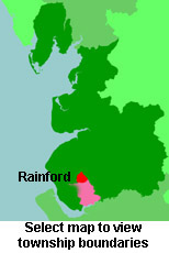
View a map of the boundaries of this town/parish.
You can see maps centred on OS grid reference SD485010 (Lat/Lon: 53.502949, -2.77724), Rainford which are provided by:
- OpenStreetMap
- Google Maps
- StreetMap (Current Ordnance Survey maps)
- Bing (was Multimap)
- Old Maps Online
- National Library of Scotland (Old Ordnance Survey maps)
- Vision of Britain (Click "Historical units & statistics" for administrative areas.)
- English Jurisdictions in 1851 (Unfortunately the LDS have removed the facility to enable us to specify a starting location, you will need to search yourself on their map.)
- Magic (Geographic information) (Click + on map if it doesn't show)
- GeoHack (Links to on-line maps and location specific services.)
- All places within the same township/parish shown on an Openstreetmap map.
- Nearby townships/parishes shown on an Openstreetmap map.
- Nearby places shown on an Openstreetmap map.
For probate purposes prior to 1858, Rainford was in the Archdeaconry of Chester, in the Diocese of Chester. The original Lancashire wills for the Archdeaconry of Chester are held at the Lancashire Record Office.
You can also see Family History Societies covering the nearby area, plotted on a map. This facility is being developed, and is awaiting societies to enter information about the places they cover.