
Hide
Tarleton
hide
Hide
hide
Hide
hide
Hide
Hide
TARLETON, a village, a parish, and a sub-district, in Ormskirk district, Lancashire. The village stands on the river Douglas, 2½ miles WNW of Croston r. station, and 8 NNE of Ormskirk; and has a post-office under Preston. The parish is cut into three divisions, and comprises 5,405 acres. Real property, £8,081. Pop., 1,987. Houses, 365. The manor belongs to Sir T. G. Hesketh, Bart., and Lord Lilford. The living is a rectory in the diocese of Manchester. Value, £960.* Patron, the Rev. M. Fletcher. The church is a plain brick building. A national school at Mere-Brow is used as a chapel of ease. There are three Methodist chapels, an endowed school with £29 a year, a school of industry, and charities £8. The sub-district contains 20 parishes. Acres, 12,139. Pop., 3,656. Houses, 667.
John Marius Wilson, Imperial Gazetteer of England and Wales (1870-72)
Hide
Local studies information is held at Ormskirk and Skelmersdale libraries.
Details about the census records, and indexes for Tarleton.
The Register Office covering the Tarleton area is West Lancashire.
The National Gazetteer of Great Britain and Ireland - 1868
"TARLETON, a parish in the hundred of Leyland, county Lancaster, 8 miles N.E. of Ormskirk, and 9½ S.W. of Preston. Chorley is its post town. The village is situated on the river Douglas, near Tarleton Moss. This parish, formerly a chapelry in the parish of Croston, is separated into three divisions, viz:, Tarleton, Holmes, and Sollom. The soil is loamy and moss, with a subsoil of clay. The living is a rectoryin the diocese of Manchester, value £800. The church, dedicated to St. John or St. Mary, was rebuilt in 1719. The parochial charities produce about £37 per annum, of which £29 go to a school. There are a school of industry and an infant school. The parish is skirted by the Leeds and Liverpool canal. Sir T. G. Hesketh, Bart., of Rufford Hall, and G. A. L. Keck, Esq., of Bank Hall, are lords of the manor. Fairs are held on the 23rd and 24th April."
- Ask for a calculation of the distance from Tarleton to another place.
View maps of Tarleton and places within its boundaries.
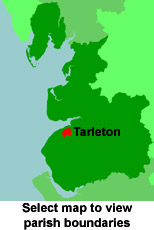
View a map of the boundaries of this town/parish.
You can see maps centred on OS grid reference SD434195 (Lat/Lon: 53.669199, -2.858022), Tarleton which are provided by:
- OpenStreetMap
- Google Maps
- StreetMap (Current Ordnance Survey maps)
- Bing (was Multimap)
- Old Maps Online
- National Library of Scotland (Old Ordnance Survey maps)
- Vision of Britain (Click "Historical units & statistics" for administrative areas.)
- English Jurisdictions in 1851 (Unfortunately the LDS have removed the facility to enable us to specify a starting location, you will need to search yourself on their map.)
- Magic (Geographic information) (Click + on map if it doesn't show)
- GeoHack (Links to on-line maps and location specific services.)
- All places within the same township/parish shown on an Openstreetmap map.
- Nearby townships/parishes shown on an Openstreetmap map.
- Nearby places shown on an Openstreetmap map.
For probate purposes prior to 1858, Tarleton was in the Archdeaconry of Chester, in the Diocese of Chester. The original Lancashire wills for the Archdeaconry of Chester are held at the Lancashire Record Office.
- Ormskirk & District Family History Society
- North Meols (Southport) Family History Society
- Lancashire Family History & Heraldry Society - Preston Branch
- Lancashire Parish Register Society
You can also see Family History Societies covering the nearby area, plotted on a map. This facility is being developed, and is awaiting societies to enter information about the places they cover.