
Hide
Earsdon
hide
Hide
hide
Hide
Hide
Hide
"Earsdon, a parish comprising the townships of Backworth, Blyth and Newsham, Burradon, Earsdon, Hartley, Holywell, Seaton Delaval, and Sighill, is bounded on the north by Bedlingtonshire, on the west by Long Benton, Cramlington, and Horton, on the south by Tynemouth, and on the east by the German Ocean. It is a rich and fertile district abounding with excellent stone and coal, of which great quantities are annually exported from Blyth and Hartley. The surface of the parish consists of gentle undulations, and is well suited for various kinds of agricultural produce It is about seven and a half miles in length by six in breadth, and comprises an area of 11,646 acres. The population in 1801, was 3,651; in 1811, 4,388; in 1821, 4,644; in 1831, 6,460; in 1811, 9,429; and in 185l, it had increased to 10,982 souls." [From History, Topography, and Directory of Northumberland, Whellan, 1855]
Hide
- Burial Registers 1860-1964, Purchased Grave Registers 1860-1902 and Burials Grant Books 1910-1957 for Blyth Civil Cemetery are available at Northumberland Archives Service.
- The 1841 Census of Backworth transcribed by Ian Percy.
- The 1851 Census Index (microfiche CN11, CN12) published by the Northumberland and Durham Family History Society may be of value to researchers interested in this parish.
- A list of ships and crews in port during the 1881 census provided by Bob Sanders.
- The ancient parish of the chapelry of Earsdon includes the village of Earsdon itself, Backworth, Burradon, Seghill, Holywell, Hartley, Seaton Delaval and Newsham. The chapel at Earsdon, demolished in 1837 and replaced by the present church, was founded before 1250. It was dedicated to Saint Alban, as is the present church.
- The Ancestral Indexes website provides information about Backworth, St John, Blyth, St Cuthbert, Earsdon, St Alban, Holywell, St Mary, New Hartley, St Michael and. Seghill Holy Trinity.
- Earsdon - Church Records - links and information.
- This area is divided between North Tyneside Registration District and Northumberland Central Registration District.
- North Tyneside - Ordering Information. Marriage Searches.
- Northumberland - Order Certificates.
- Earsdon - Description and Travel - links and information.
- Population and housing figures for townships in Earsdon Parish from the 1881 Census.
- The section of The National Gazetteer (1868) relating to this parish - transcribed by Colin Hinson.
- Ask for a calculation of the distance from Earsdon to another place.
- Earsdon - History - links and information.
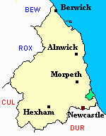
- Earsdon - Maps - links and information.
You can see maps centred on OS grid reference NZ307762 (Lat/Lon: 55.079441, -1.520577), Earsdon which are provided by:
- OpenStreetMap
- Google Maps
- StreetMap (Current Ordnance Survey maps)
- Bing (was Multimap)
- Old Maps Online
- National Library of Scotland (Old Ordnance Survey maps)
- Vision of Britain (Click "Historical units & statistics" for administrative areas.)
- English Jurisdictions in 1851 (Unfortunately the LDS have removed the facility to enable us to specify a starting location, you will need to search yourself on their map.)
- Magic (Geographic information) (Click + on map if it doesn't show)
- GeoHack (Links to on-line maps and location specific services.)
- All places within the same township/parish shown on an Openstreetmap map.
- Nearby townships/parishes shown on an Openstreetmap map.
- Nearby places shown on an Openstreetmap map.
- Migration data derived from the 1813 baptism entries for Earsdon Parish.
- A transcript of New Hartley War Memorial provided by Ancestral Indexes.
- Surnames from the 1813 baptism entries for Earsdon Parish.
- Occupations mentioned in the 1813 baptism entries for Earsdon Parish.
- Earsdon Parish was part of Tynemouth Poor Law Union. The Union Workhouse was located in Preston Lane, North Shields. Some useful records are held at Tyne and Wear Archives Service.
- Peter Higginbotham has provided details, a map, plan and photograph of Tynemouth Workhouse.
- Population and housing figures for townships in Earsdon Parish from the 1881 Census.
- Holywell: Ron Branscombe's list of all documents relating to Holywell currently held by Northumberland Archives Service.