
Hide
Startforth
hide
Hide
hide
Hide
Hide
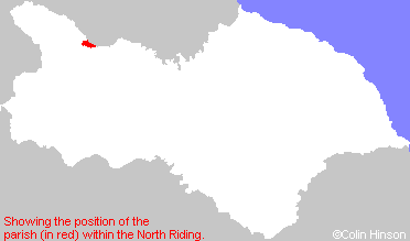
The Ancient Parish of STARTFORTH
[Transcribed information mainly from the early 1820s]
"STARTFORTH, a parish in the wapentake of Gilling West, and liberty of Richmondshire; 1 mile W. of Barnard Castle; a small irregularly built village, situated on the banks of the Tees, opposite Barnard Castle. The church, which is dedicated to the Holy Trinity (see Churches for photograph), is an ancient structure; the living is a vicarage, in the patronage of the Earl of Lonsdale. Pop. 460.""BOLDRON, in the parish of Startforth, wapentake of Gilling West, & liberty of Richmondshire; 1¼ miles SSW. of Startforth, 2 miles SSW. of Barnard Castle. Pop. 168."
[Description(s) edited mainly from various 19th century sources by Colin Hinson. ©2010]
Hide
- The Boldron Parish History Group website had a transcription of the Boldron Census for 1841, 1881 and 1901 by Catherine Ryan. [Regretably, this group have moved their page to facebook and I have no idea what they have done with this page.]
- Here are photographs of Churches in the parish:
- Holy Trinity Church, Startforth (view 1).
- Holy Trinity Church, Startforth (view 2).
- The Mission Church, Boldron view 1.
- The Mission Church, Boldron view 2.
- The Methodist Church, Boldron.
- Transcript of the entry for Startforth in the "Collections relative to Churches and Chapels".
- The whereabouts and dates of the Registers etc. for the Parish of Startforth.
- Transcript of the entry of "professions and trades" in the Baines's Directory of 1823, of the North Riding.
- Transcript of the entry of "professions and trades" in the Bulmers Directory of 1890. of the North Riding.
- There is further information about this parish from the National Gazetteer 1868, Yorkshire extracts.
- There is further information about this parish from the Lewis's Topographical Dictionary of England 1835, Yorkshire extracts.
- There is further information about this parish from the Bulmer's 1890 History and Directory of the North Riding.
- Ask for a calculation of the distance from Startforth to another place.
- The Boldron Parish History Group website had a transcription of the Boldron Census for 1841, 1881 and 1901 by Catherine Ryan, along with a report on the Startforth War Memorial. [Regretably, this group have moved their page to facebook and I have no idea what they have done with the census page.]
- For a detailed map of this parish see this parish boundaries map.
- For a more detailed map of the parishes in the riding please see the Yorkshire parish maps page.
- For a more detailed map of the county please see the Yorkshire map page.
- Here is a map showing the wapentakes for the county.
You can see maps centred on OS grid reference NZ040160 (Lat/Lon: 54.539251, -1.93969), Startforth which are provided by:
- OpenStreetMap
- Google Maps
- StreetMap (Current Ordnance Survey maps)
- Bing (was Multimap)
- Old Maps Online
- National Library of Scotland (Old Ordnance Survey maps)
- Vision of Britain (Click "Historical units & statistics" for administrative areas.)
- English Jurisdictions in 1851 (Unfortunately the LDS have removed the facility to enable us to specify a starting location, you will need to search yourself on their map.)
- Magic (Geographic information) (Click + on map if it doesn't show)
- GeoHack (Links to on-line maps and location specific services.)
- All places within the same township/parish shown on an Openstreetmap map.
- Nearby townships/parishes shown on an Openstreetmap map.
- Nearby places shown on an Openstreetmap map.
- The following places are within the boundaries of this (ancient) parish, but I have no further information on them other than the Ordnance Survey Landranger Grid reference shown:
- (NZ031155) Startforth Grange
- The Boldron Parish History Group have regretably moved their page(s) to facebook so that only half of the population can see it properly!
- This parish is covered by the following Society: