
Hide
Maps of Yorkshire
hide
Hide
Hide
YORKSHIRE:
Maps of Yorkshire
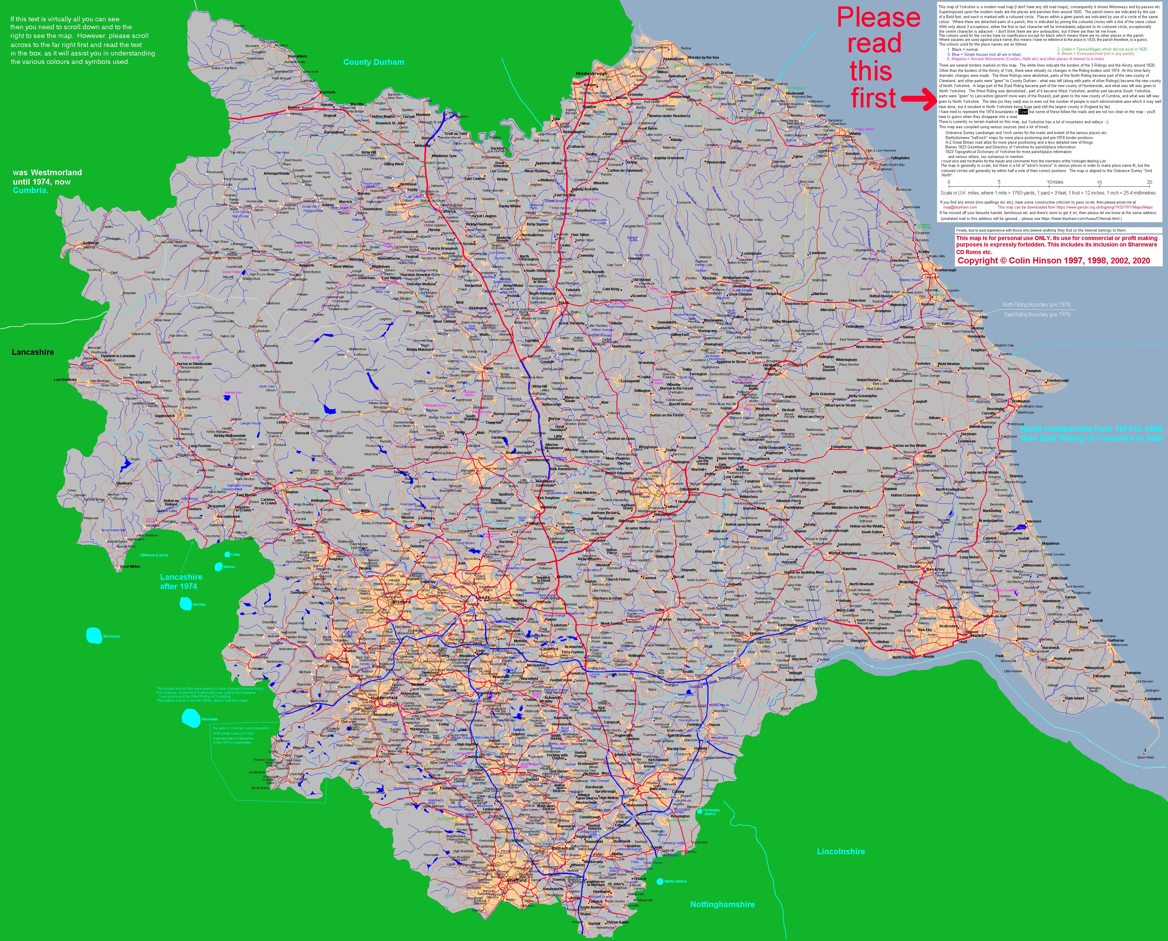
Source=h:/!Genuki/RecordTranscriptions/YKS/Maps.txt Detailed map of Yorkshire.
Parish Maps of the Ridings.
A map showing the Ridings.
(20 times reduction of actual map size)
Detailed map of Yorkshire.
This map shows all the cities, towns and villages, rivers and becks, and most of the hamlets and some of the single houses in the Yorkshire of the 1820s. Wherever possible the new towns and villages have been added. There are currently no contours shown, but the current extent of all the larger places are shown.
Downloading the map:
Download the map, and then save it (right click on the map, and then select "Save picture as"). If you have a good graphics program, then you should be able to zoom in and out when displaying the image. Please do not save it to a jpeg file as this will give a file several times larger than the .png file, and will result in a poorer image too. (If you want to know why, see my pages about dealing with image files for the web).
Printing the map:
Bill Potts has investigated printing the map and recommends using a program called Poster. He has kindly allowed me to reproduce his comments and instructions for the use of "Poster".
Please remember this is a large file (around 950kbytes) and therefore it may take some time to download if you are not using broadband.
Written and drawn by Colin Hinson © 2017
Parish maps of the Ridings
 | 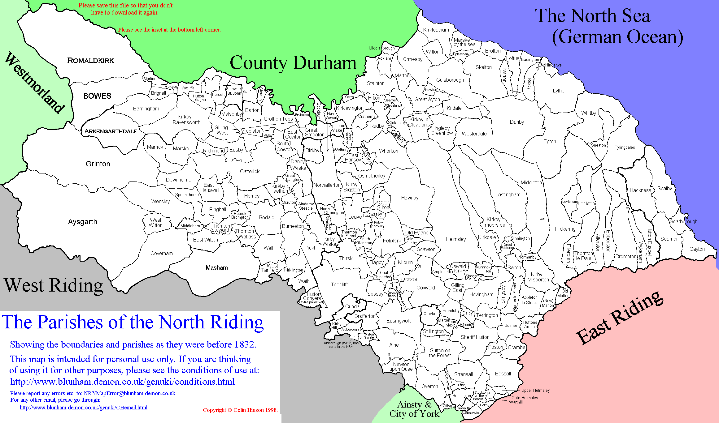 | 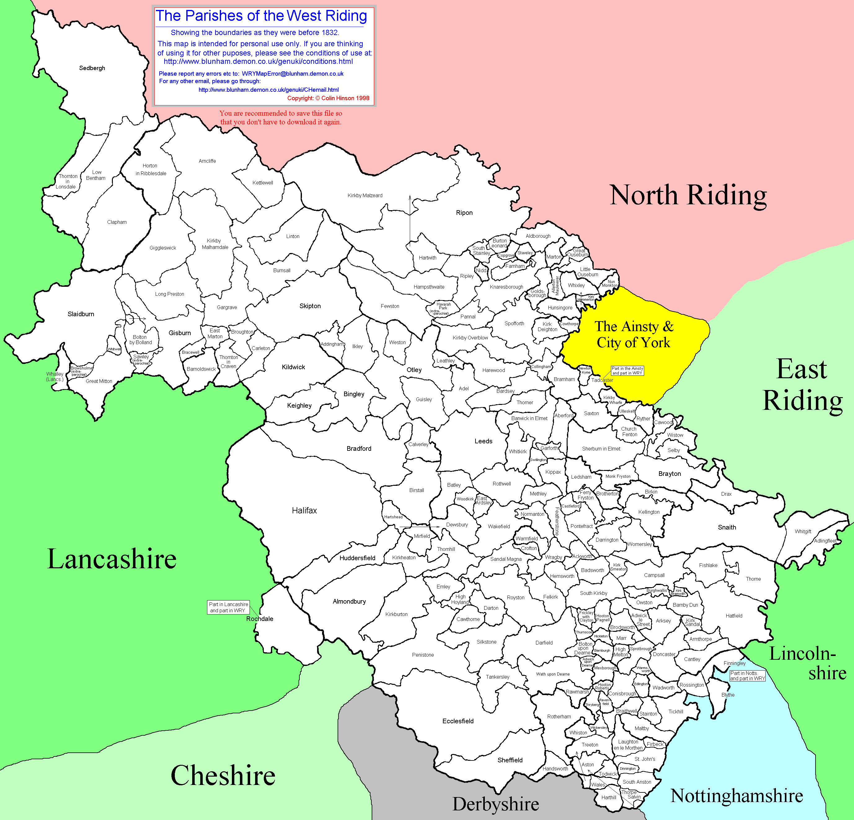 |
| East Riding Parish Map including The Ainsty | ||
(Maps above are shown at 7% of actual size) | ||
The above maps show the boundaries of the parishes as they were before 1832 when the Civil Parishes started coming into being, all three of the maps are in .gif format. The names all agree with the lists of parishes given for the 3 Ridings and The Ainsty within the Genuki Yorkshire page, under Towns and Parishes. The North Riding map is to a different scale than the other two (approximately 20% smaller).
I would recommend that you save the map(s) having downloaded them to your browser, as this will save you having to download them again and also enable you to use your own graphics software to display them. Please do not save it to a jpeg file as this will give a file several times larger than the .png file, and will result in a poorer image too. (If you want to know why, see my pages about dealing with image files for the web).
To display the maps (having saved them), I would recommend that you use Paint Shop Pro or similar program with a zoom in and out capability (I used Paint Shop Pro 5 to generate the maps).
Please see also the map of the Wapentakes of Yorkshire and the detailed place map of Yorkshire.
Written and drawn by Colin Hinson © 2017
A map showing the Ridings etc
| Many people are very confused when it comes to the Ridings of Yorkshire, their boundaries, and their importance in Yorkshire family history research. Whatever part of Yorkshire you find yourself researching it is vital that you think in terms of the Ridings and not the present day post 1974 Yorkshire boundaries. While it is possible to find maps of Yorkshire in libraries and on the web, it is not always possible to find a pre 1974 map. For this reason I have produced the map below which clearly shows the old and the new county boundaries. |
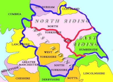 |
The present day counties are shown with a thin black boundary and black typeface. The old West, North and East Ridings are bounded by a thick blue line and divided with a red line, the Ainsty of York in the centre. Note: after Tana wrote this article, North Humberside changed its name to "The East Riding of Yorkshire" (not the same as the old East Riding). |
Written and drawn by Tana Willis-Johnson ©2010