
Hide
Stenton, Church of Scotland
hide
Hide
Hide
Church of Scotland,
Stenton
Hide
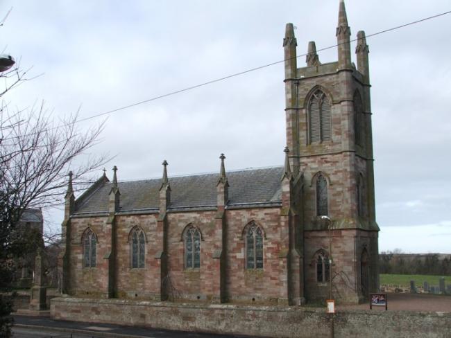
The current church was built in 1829, as a replacement for the older parish church nearby which was too small, and in need of extensive repairs.
Canmore has a number of photos and architectural drawings of the church.
OPRs (Old Parish Registers) are available from 1679 (Births) and 1668 (Marriages and Deaths). The early births (up to 1706) are largely damaged or missing. Deaths (or Mortcloth Dues) also have a significant number of omissions.
The NRS website provides more details on the available records, and gaps and omissions.
It is located at NT6215974281 (Lat/Lon 55.960046, -2.60768). You can see this on maps provided by:
- OpenStreetMap
- Google Maps
- StreetMap (Current Ordnance Survey maps)
- Bing (was Multimap)
- Old Maps Online
- National Library of Scotland (Old Ordnance Survey maps)
- Vision of Britain (Click "Historical units & statistics" for administrative areas.)
- Magic (Geographic information) (Click + on map if it doesn't show)
- GeoHack (Links to on-line maps and location specific services.)
The IWM database contains details of the war memorial in the church grounds, and its inscriptions.