
Hide
Parish Maps from 'Historic Parishes of England and Wales - Boundaries before 1850'
hide
Hide
Prendergast Parish Map part 85
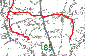
Prendergast Parish Map part 85
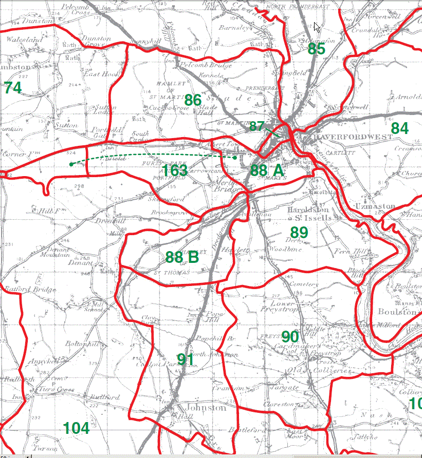
Haverfordwest, St Martin Parish Map 86
Haverfordwest, St Mary's Parish Map 87
Haverfordwest, St Thomas Parish Map 88A & 88B
Furzy Park and Portfield 163
(Shown separately on the map, possibly extra parochial but as part of St Thomas's on the Dyfed FHS parish map.)
Haroldston, St Issels Parish Map 89
Freystrop Parish Map 90
Johnston Parish Map 91
Nolton Parish Map part 92
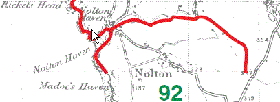
Nolton Parish Map part 92
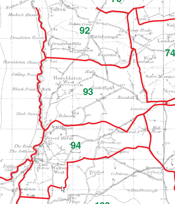
Haroldston West 93
Walton West Parish Map 94
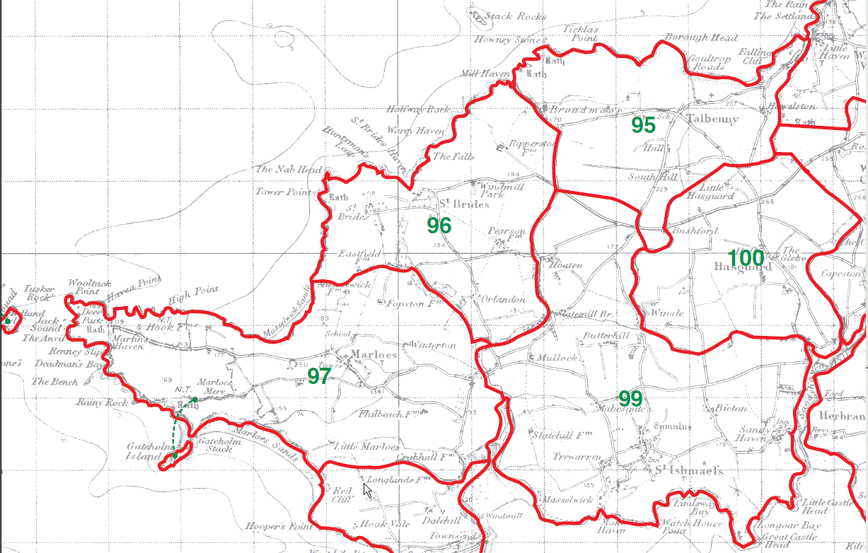
Talbenny Parish Map 95
St Brides Parish Map 96
Marloes Parish Map 97
St Ishmaels parish Map 99
Hasguard Parish Map 100
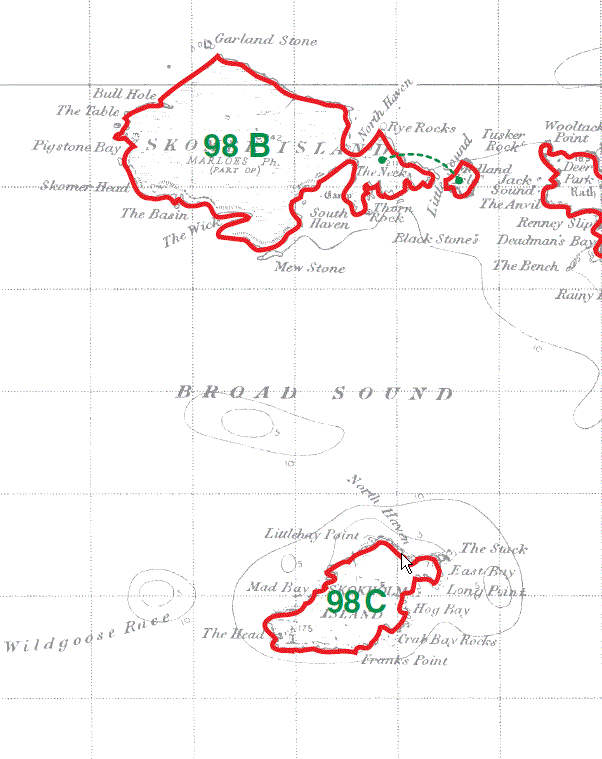
Skomer Island (Haverfordwest, St Martin Parish) 98B
Skokholm Island (Dale Parish) 98C
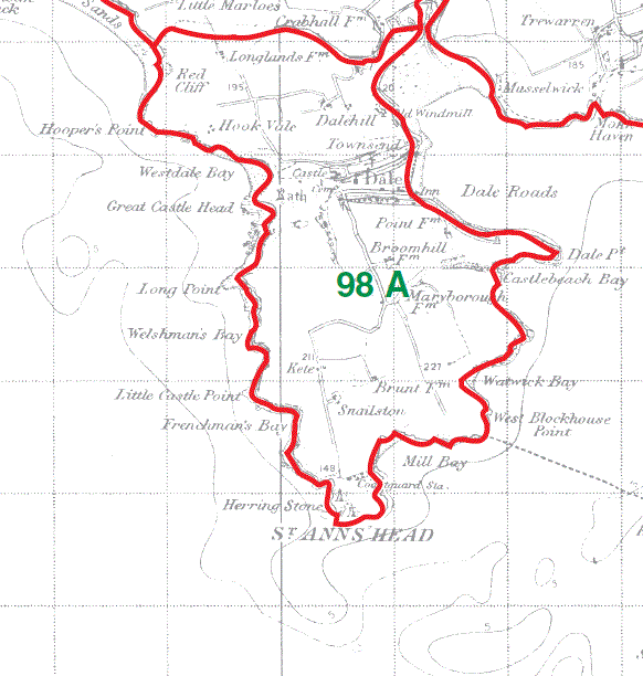
Dale Parish Map 98A
This map is extracted from:
Kain, R.J.P., Oliver, R.R., Historic Parishes of England and Wales: an Electronic Map of Boundaries before 1850 with a Gazetteer and Metadata [computer file]. Colchester, Essex: History Data Service, UK Data Archive [distributor], 17 May 2001. SN: 4348.
Acknowledgement is made to R.J.P. Kain, R.R Oliver, the Economic and Social Research Council, the History Data Service and the UK Data Archive.
Gareth Hicks 29 Dec 2012)
Copyright © GENUKI and Contributors 1996 to date |