
Hide
Pendleton
hide
Hide
hide
Hide
hide
Hide
Hide
"PENDLETON, a suburban town, a township, a chapelry, and a sub-district, in Salford district, Lancashire. The town is suburban to Manchester; lies on the Manchester and Bolton railway, near Peel Park, contiguous to the W side of Salford, 2 miles W N W of Manchester: contains very many genteel residences; carries on industry in cotton and flax mills, and in dye and print-works; and has a railway station with telegraph, a post-office, under Manchester, a town hall, and numerous places of worship, and public schools. The town hall was built in 1866, at a cost of about £9,000; is in the Italian style, with assimilation to French; and contains an assembly-room, 85 feet long, 39½ feet wide, and 30 feet high. The churches are St. Thomas', rebuilt in 1831, and Sts. Paul, George, James, Anne, and Luke, built in 1856-65 at costs of £5,000, £5,000, £8,500, £1,500, and £6,500. A New Connexion Methodist chapel was built in 1863, at a cost of £2,500; and has a Corinthian portico. Independent school-rooms were erected in 1865, at a cost of £2,400; are in the geometric pointed style; and includea central hall, 60 feet long and 40 feet wide. Very handsome Wesleyan schools were erected in 1863, at a cost of £3500. The township comprises 1,720 acres; and is in the parish of Eccles, and the borough of Salford. Real property, £85,080; of which £2,186 are in mines, and £1,024 in ironworks. Pop. in 1851, 14,244; in 1861, 20,900. Houses, 3,906. Coal exists in seams of 7 feet thick and under, and is largely worked. The chapelry includes but a portion of the township, and was constituted in 1860. Pop. in 1861, 5,361. Houses, 984. The living is a p. curacy in the diocese of Manchester. Value, £344. Patron, the Vicar of Eccles. The sub-district comprises the townships of Pendleton and Pendlebury. Acres, 2,650. Pop., 24,448. Houses, 4,578."
John Marius Wilson, Imperial Gazetteer of England and Wales (1870-72)
Hide
Local studies information is held at Salford library.
Details about the census records, and indexes for Pendleton.
The Register Office covering the Pendleton area is Salford.
The National Gazetteer of Great Britain and Ireland - 1868
"PENDLETON, a township and chapelry in the parish of Eccles, hundred of Salford, county Lancaster, 3 miles from Manchester, its post town, and 7½ N. of Bolton. It is a station on the western section of the Lancashire and Yorkshire railway. The village, which is considerable, may be considered a suburb of Manchester. It is situated on the main road from Manchester to Bolton. A large portion of the inhabitants are employed in the collieries and cotton mills, and some in the dyeing, printing, and bleaching establishments. Adjacent to the village are many villas. The living is a perpetual curacy in the diocese of Manchester, value £344, in the patronage of the Vicar of Eccles. The church, erected in 1831, is dedicated to St. John. There is also a chapel-of-ease, dedicated to St. Thomas. The charities produce £4 per annum. The Independents, Wesleyans, and New Connexion Methodists have places of worship."
"PADDINGTON, a village in the parish and city of Manchester, hundred of Salford, county Lancaster, about 1 mile from Manchester, of which it is a suburb. The living is a perpetual curacy in the diocese of Manchester, value £300, in the patronage of the crown and bishop alternately."
- Ask for a calculation of the distance from Pendleton to another place.
In 1835 Pendleton was a township in the parish of Eccles.
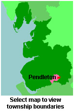
View maps of Pendleton and places within its boundaries.
View a map of the boundaries of this town/parish.
You can see maps centred on OS grid reference SJ803995 (Lat/Lon: 53.492019, -2.298578), Pendleton which are provided by:
- OpenStreetMap
- Google Maps
- StreetMap (Current Ordnance Survey maps)
- Bing (was Multimap)
- Old Maps Online
- National Library of Scotland (Old Ordnance Survey maps)
- Vision of Britain (Click "Historical units & statistics" for administrative areas.)
- English Jurisdictions in 1851 (Unfortunately the LDS have removed the facility to enable us to specify a starting location, you will need to search yourself on their map.)
- Magic (Geographic information) (Click + on map if it doesn't show)
- GeoHack (Links to on-line maps and location specific services.)
- All places within the same township/parish shown on an Openstreetmap map.
- Nearby townships/parishes shown on an Openstreetmap map.
- Nearby places shown on an Openstreetmap map.
For probate purposes prior to 1858, Pendleton was in the Archdeaconry of Chester, in the Diocese of Chester. The original Lancashire wills for the Archdeaconry of Chester are held at the Lancashire Record Office.
You can also see Family History Societies covering the nearby area, plotted on a map. This facility is being developed, and is awaiting societies to enter information about the places they cover.