
Hide
St Nicholas Olave
hide
Hide
hide
Hide
Hide
Hide
"The PARISH of St. Nicholas OLAVE. On the West Side whereof was the Parish Church of St. Nicholas Olave, a convenient Church. This Church was repaired and beautified in the Year of Our Lord God 1623. The Cost of it 24 l. Since that in the Year 1628, the South Isle, that was like a Cottage before, only tiled, was ceiled, and that decently and gracefully finished. Which, with some Cost bestowed on the Steeple, did arise to the Sum of 22 l. This Church, demolished by the great Fire, remains unbuilt, and the Parish united to St. Nicholas Cole-abbey. [John Stow, John Mottley. A survey of the cities of London and Westminster . . . (1733-35) - transcribed by Brian Randell]
Hide
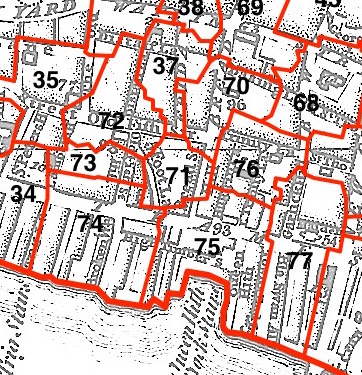
This parish - no. 71 in the above map - is located in Queenhithe Ward.
The church was destroyed in 1666 and not rebuilt.
The parish was later united with St Nicholas Cole Abbey 1670.
Hide
London Metropolitan Archive holdings for St Nicholas Olave.
Online Parish Register Images and Indexes for St Nicholas Olave parish are provided by, or at various subscription sites via, the LDS FamilySearch wiki.
No non-Church of England denominations have been identified for St Nicholas Cole Abbey with St Nicholas Olave [LDS FamilySearch Wiki].
Wikipedia page on St Nicholas Olave.
- Ask for a calculation of the distance from St Nicholas Olave to another place.
Summary history of St Nicholas Olave parish, from the Worshipful Company of Parish Clerks.
Public Houses, Inns & Taverns of the parish of St Nicholas Olave - provides "information from census records, trade directories, etc."
You can see maps centred on OS grid reference TQ322809 (Lat/Lon: 51.511835, -0.095701), St Nicholas Olave which are provided by:
- OpenStreetMap
- Google Maps
- StreetMap (Current Ordnance Survey maps)
- Bing (was Multimap)
- Old Maps Online
- National Library of Scotland (Old Ordnance Survey maps)
- Vision of Britain (Click "Historical units & statistics" for administrative areas.)
- English Jurisdictions in 1851 (Unfortunately the LDS have removed the facility to enable us to specify a starting location, you will need to search yourself on their map.)
- Magic (Geographic information) (Click + on map if it doesn't show)
- GeoHack (Links to on-line maps and location specific services.)
- All places within the same township/parish shown on an Openstreetmap map.
- Nearby townships/parishes shown on an Openstreetmap map.
- Nearby places shown on an Openstreetmap map.
Surnames from the 1881 census in the St Nicholas Olave and St Nicholas Olave London districts.
Clerical career summaries for the parish of St Nicholas Olave, from the Clergy of the Church of England Database website.
Sources for listings of taxpayer names for St Nicholas Olave parish, listed on the FamilySearch wiki.