
Hide
Weaverthorpe
hide
Hide
hide
Hide
Hide
The Ancient Parish of WEAVERTHORPE
[Transcribed information mainly from the early 1820s]
"WEAVERTHORPE, a parish in the wapentake of Buckrose; 12 miles E. of Malton. The living of the parish church (see Churches for photograph) is in the gift of the Dean and Chapter of York, and the Rev. Rd. Forrest is the vicar. Pop. 334.""DOTTEREL COTTAGE, a farm house in the township and parish of Weaverthorpe; ½ mile WNW. of Weaverthorpe, 4½ miles from Sledmere."
"EAST LUTTON, in the parish of Weaverthorpe, wapentake of Buckrose, & liberty of St. Peter's; 1¾ miles WSW. of Weaverthorpe, 11 miles E. of Malton."
"WEST LUTTON, in the parish of Weaverthorpe, wapentake of Buckrose, and liberty of St. Peter's; 2¼ miles WSW. of Weaverthorpe, 10 miles E. of Malton. Population, including East Lutton together with which it forms Luttons Ambo, 311."
[Description(s) edited mainly from various 19th century sources by Colin Hinson. ©2010]
Hide
- Photographs of over 330 gravestones at Weaverthorpe Church with linked surname index.
- Photographs of over 140 gravestones at West Lutton Church with linked surname index.
- Here are photographs of Churches in the parish:
- St. Andrew's Church, Weaverthorpe.
- St. Andrew's Church (showing the Lyche Gate), Weaverthorpe.
- Internal view looking down the nave
- The East Window
- The font
- Wolds Valley Methodist Chapel, Weaverthorpe.
- St. Mary's Church, West Lutton.
- Internal view looking down the nave
- The East Window
- The font
- St. Mary's Church (showing the Lyche Gate), West Lutton.
- The former Methodist Chapel, West Lutton, now a private residence (2006).
- The former Methodist Chapel, West Lutton, now a private residence (2009).
- Transcript of the entry for Weaverthorpe in the "Collections relative to Churches and Chapels".
- Transcript of the entry for Luttons Ambo in the "Collections relative to Churches and Chapels".
- The whereabouts and dates of the Registers etc. for the Parish of Weaverthorpe.
- The List of Vicars in Weaverthorpe church.
- The List of Vicars in West Lutton church.
- Transcript of the entry of "professions and trades" in the Baines's Directory of 1823, of the East Riding.
- Transcript of the entry of "professions and trades" in the Bulmers Directory of 1892. of the East Riding.
- Transcript of the entry of "professions and trades" in the The Scarborough Gazette of 1905,
- There is further information about this parish from the National Gazetteer 1868, Yorkshire extracts.
- There is further information about this parish from the Lewis's Topographical Dictionary of England 1835, Yorkshire extracts.
- There is further information about this parish from the Bulmer's 1892 History and Directory of the East Riding.
- Ask for a calculation of the distance from Weaverthorpe to another place.
- In 1875, the township of West Lutton and the hamlet of East Lutton (already physically detached from this parish) together formed the parish of Luttons Ambo.
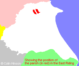
- For a detailed map of this parish see this parish boundaries map.
- For a more detailed map of the parishes in the riding please see the Yorkshire parish maps page.
- For a more detailed map of the county please see the Yorkshire map page.
- Here is a map showing the wapentakes for the county.
You can see maps centred on OS grid reference SE966708 (Lat/Lon: 54.123994, -0.523397), Weaverthorpe which are provided by:
- OpenStreetMap
- Google Maps
- StreetMap (Current Ordnance Survey maps)
- Bing (was Multimap)
- Old Maps Online
- National Library of Scotland (Old Ordnance Survey maps)
- Vision of Britain (Click "Historical units & statistics" for administrative areas.)
- English Jurisdictions in 1851 (Unfortunately the LDS have removed the facility to enable us to specify a starting location, you will need to search yourself on their map.)
- Magic (Geographic information) (Click + on map if it doesn't show)
- GeoHack (Links to on-line maps and location specific services.)
- All places within the same township/parish shown on an Openstreetmap map.
- Nearby townships/parishes shown on an Openstreetmap map.
- Nearby places shown on an Openstreetmap map.
- The 1914-1918 War Memorial in the middle of the village.
- The WWI Memorial plaque in West Lutton church.
- The following places are within the boundaries of this (ancient) parish, but I have no further information on them other than the Ordnance Survey Landranger Grid reference shown:
- (SE933709) Haverdale House
- This parish is covered (or partly covered) by the following Societies:
- The 1834 Electoral Roll for this parish