Hide
Easington
hide
Hide
hide
Hide
Hide
hide
Hide
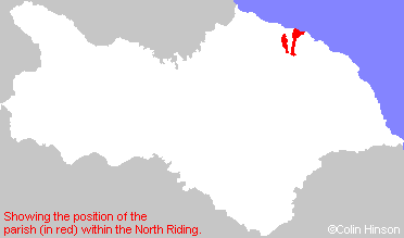
The Ancient Parish of EASINGTON
[Transcribed information mainly from the early 1820s]
"EASINGTON, a parish in the wapentake and liberty of Langbargh; 10 miles ENE. of Guisborough, gives name to a parish of considerable extent, stretching from North to South upwards of six miles, and about two miles broad, it comprehends the several manors of Easington, Boulby, and Liverton, all of which, according to Domesday survey, were anciently within the soke of the manor of Lofthouse, held in the Conqueror's time by Hugh, Earl of Chester, and was then uncultivated, except Easington, in which there was one villain, with one plough. a church without a minister, and a wood, with a pasturage for cattle one mile long and half a mile broad. The church is dedicated to All Saints (see Churches for photograph), the living a rectory, in the gift of the King, incumbent the Rev. Matthew Mappletoft, D. D. the Rev. James Metcalf, curate. Population, 507.""BOULBY, in the parish of Easington, wapentake and liberty of Langbargh; 1¼ miles ENE. of Easington, 11 miles NW. of Whitby." (There is further information for Boulby).
"GRINKLE PARK, (the seat of Robert Wharton Myddleton, Esq.) in the township and parish of Easington; 2 miles S. of Easington, 11 miles from Guisborough, 14 from Whitby."
"LIVERTON, in the parish of Easington, wapentake and liberty of Langbargh; 2½ miles SW. of Easington, 8 miles ENE. of Guisborough. Population, 251.
It is an ancient chapelry dependent on the church of Easington. The chapel has parochial rights, but the inhabitants pay no acknowledgement to Easington. -Graves. Curate, Rev. James Metcalfe, of Easington."
"SCALING, in the parishes of Hinderwell and Easington, wapentake and liberty of Langbargh; 2¾ miles S. of Easington, 10 miles E. of Guisborough."
"SCALING DAM, a public house in the parish of Easington, wapentake and liberty of Langbargh; 3¼ miles S. of Easington, 10 miles E. of Guisborough, & 11 W. of Whitby, situated on the high road leading from Guisborough to Whitby."
"UPTON, 2 farm houses in the parish of Easington, wapentake and liberty of Langbargh; ¾ mile NNW. of Easington."
[Description(s) edited mainly from various 19th century sources by Colin Hinson. ©2010]
Hide
- Here are photographs of Churches in the parish:
- All Saints' Church, Easington. No key available for visitors.
- St. Michael's Church, Liverton. No key available for visitors.
- Transcript of the entry for Easington in the "Collections relative to Churches and Chapels".
- Transcript of the entry for Liverton in the "Collections relative to Churches and Chapels".
- The whereabouts and dates of the Registers etc. for the Parish of Easington.
- The whereabouts and dates of the Registers etc. for the Chapelry of Liverton.
- Transcript of the entry of "professions and trades" in the Baines's Directory of 1823, of the North Riding.
- Transcript of the entry of "professions and trades" in the White's Directory of 1840, Yorkshire section.
- Transcript of the entry of "professions and trades" in the Bulmers Directory of 1890. of the North Riding.
- There is further information about this parish from the National Gazetteer 1868, Yorkshire extracts.
- There is further information about this parish from the Lewis's Topographical Dictionary of England 1835, Yorkshire extracts.
- There is further information about this parish from the Bulmer's 1890 History and Directory of the North Riding.
- Ask for a calculation of the distance from Easington to another place.

- For a detailed map of this parish see this parish boundaries map.
- For a more detailed map of the parishes in the riding please see the Yorkshire parish maps page.
- For a more detailed map of the county please see the Yorkshire map page.
- Here is a map showing the wapentakes for the county.
You can see maps centred on OS grid reference NZ744180 (Lat/Lon: 54.551789, -0.851237), Easington which are provided by:
- OpenStreetMap
- Google Maps
- StreetMap (Current Ordnance Survey maps)
- Bing (was Multimap)
- Old Maps Online
- National Library of Scotland (Old Ordnance Survey maps)
- Vision of Britain (Click "Historical units & statistics" for administrative areas.)
- English Jurisdictions in 1851 (Unfortunately the LDS have removed the facility to enable us to specify a starting location, you will need to search yourself on their map.)
- Magic (Geographic information) (Click + on map if it doesn't show)
- GeoHack (Links to on-line maps and location specific services.)
- All places within the same township/parish shown on an Openstreetmap map.
- Nearby townships/parishes shown on an Openstreetmap map.
- Nearby places shown on an Openstreetmap map.
- This parish is covered by the following Society:

