
Hide
Brindle
hide
Hide
hide
Hide
hide
Hide
Hide
BRINDLE, a parish and a subdistrict in Chorley district, Lancashire. The parish lies on the Leeds and Liverpool canal, and on the Preston and Blackburn railway, near Bamber-Bridge station, 5 miles N by E of Chorley; and has a post office under Chorley. Acres, 2,935. Real property, £6,401. Pop., 1,501. Houses, 265. The manor belongs to Lord Chesham. There are a cotton factory, print-works, chemical-works, brickworks, and quarries. The living is a rectory in the diocese of Manchester. Value, £515.* Patron, the Duke of Devonshire. The church is good; and there are a chapel at B.-Heath, built in 1864, a Roman Catholic chapel, a large boarding-school, a workhouse, and charities £31. The subdistrict includes also part of Leyland parish. Acres, 10,388. Pop., 6,021. Houses, 1,112.
John Marius Wilson, Imperial Gazetteer of England and Wales (1870-72)
Hide
Local studies information is held at Chorley library.
| St James, Brindle, Church of England |
| St Joseph Roman Catholic, Brindle |
Details about the census records, and indexes for Brindle.
| St James, Brindle, Church of England |
| St Joseph Roman Catholic, Brindle |
The Register Office covering the Brindle area is Chorley.
The National Gazetteer of Great Britain and Ireland - 1868
"BRINDLE, a parish in the hundred of Leyland, in the county palatine of Lancaster, 4 miles to the N. of Chorley. Muslin weaving is carried on by some of the inhabitants. The living is a rectory in the diocese of Manchester, of the value of £515, in the patronage of the Duke of Devonshire. The church is dedicated to St. James. There is an endowed free school with an income of about £17 a year, the produce of several bequests. There are some other charities worth about £14 a year. Brindle Lodge is the principal mansion."
- Ask for a calculation of the distance from Brindle to another place.
View maps of Brindle and places within its boundaries.
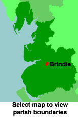
View a map of the boundaries of this town/parish.
You can see maps centred on OS grid reference SD600242 (Lat/Lon: 53.71291, -2.606839), Brindle which are provided by:
- OpenStreetMap
- Google Maps
- StreetMap (Current Ordnance Survey maps)
- Bing (was Multimap)
- Old Maps Online
- National Library of Scotland (Old Ordnance Survey maps)
- Vision of Britain (Click "Historical units & statistics" for administrative areas.)
- English Jurisdictions in 1851 (Unfortunately the LDS have removed the facility to enable us to specify a starting location, you will need to search yourself on their map.)
- Magic (Geographic information) (Click + on map if it doesn't show)
- GeoHack (Links to on-line maps and location specific services.)
- All places within the same township/parish shown on an Openstreetmap map.
- Nearby townships/parishes shown on an Openstreetmap map.
- Nearby places shown on an Openstreetmap map.
For probate purposes prior to 1858, Brindle was in the Archdeaconry of Chester, in the Diocese of Chester. The original Lancashire wills for the Archdeaconry of Chester are held at the Lancashire Record Office.
- Lancashire Family History & Heraldry Society - Chorley Branch
- Lancashire Family History & Heraldry Society - Preston Branch
- Lancashire Parish Register Society
You can also see Family History Societies covering the nearby area, plotted on a map. This facility is being developed, and is awaiting societies to enter information about the places they cover.