
Hide
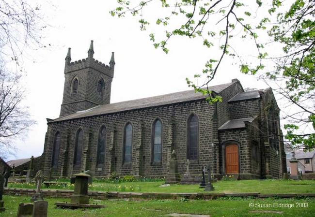
Christ Church Church of England, Colne
Hide
Maintainers
The updates have been applied on the "anchor" issue on 27 July.
The issues are discussed here
Details are also on the maintainers list.
hide
Hide
Hide
Hide
It was founded in 1836.
This site provides historical information about churches, other places of worship and cemeteries. It has no connection with the churches themselves. For current information you should contact them directly.
It is located at SD9075940478 (Lat/Lon 53.860439, -2.141987). You can see this on maps provided by:
- OpenStreetMap
- Google Maps
- StreetMap (Current Ordnance Survey maps)
- Bing (was Multimap)
- Old Maps Online
- National Library of Scotland (Old Ordnance Survey maps)
- Vision of Britain (Click "Historical units & statistics" for administrative areas.)
- English Jurisdictions in 1851 (Unfortunately the LDS have removed the facility to enable us to specify a starting location, you will need to search yourself on their map.)
- Magic (Geographic information) (Click + on map if it doesn't show)
- GeoHack (Links to on-line maps and location specific services.)