Hide
Abbey Road Cemetery, Dalton-in-Furness
hide
Hide
Hide
Dalton-in-Furness Cemetery,
Cemetery Hill,
Dalton-in-Furness
Hide
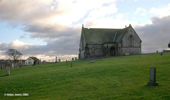
Dalton Cemetery was established in 1862. Until the Barrow-in-Furness Cemetery was opened in 1873, many burials from the rapidly expanding new town of Barrow had to go to Dalton.
The North Chapel, formerly the Church of England mortuary chapel, is also used twice a month for services of the Greek Orthodox Community of St Simon (q.v.). The South Chapel, formerly the nonconformist mortuary chapel, is now disused.
The Cemetery. - Barrow, though now a separate parish, was for some years dependent upon the mother-church of Dalton, and all its dead were carried thither for interment. The limited extent of the burial-ground attached to the church, and the increasing number of interments, soon rendered necessary another and more commodious cemetery. Accordingly a Burial Board was formed ; the site fixed upon was the high ground rising from the Abbey Road and overlooking the lower portion of the village, which is well adapted for the purpose. Devious walks wind through the grounds, lined by rows of weeping willow, ash, laburnum, &c., whilst the funereal yew lends variety to the landscape by the sombre tints of its foliage; and amongst the monumental headstones may be noted the absence of those foolish inscriptions and poetic effusions which disgrace the grave-yards of too many of our parish churches. There are two mortuary chapels, one appropriated to the Church of England and the other to the Dissenters. The Cemetery was opened in 1802, further enlarged in 1873, and now covers an area of ten acres.from Mannex's directory of Furness & Cartmel, 1882
The original Dalton burial registers were badly damaged in an arson attack on the cemetery office in 1985. A new transcript of the damaged pages was produced during the following year, although a small number of early entries could not be recovered, despite utilising additional information obtained from gravestones . The cemetery is now administered by Barrow Borough Council and the registers are kept at the Cemetery Office in Barrow. For the 1862-1967 period, microfiche copies of the 1986 transcript are also available at the Cumbria Record Office, Barrow.
Whilst every effort has been made to record exact details of record office and library holdings you are recommended to check with them before visiting to ensure that they do hold the records and years you wish to examine. Similarly check with transcript publishers to ensure they cover the records and years you require before making a purchase.
This site provides historical information about churches, other places of worship and cemeteries. It has no connection with the churches themselves. For current information you should contact them directly.
- OpenStreetMap
- Google Maps
- StreetMap (Current Ordnance Survey maps)
- Bing (was Multimap)
- Old Maps Online
- National Library of Scotland (Old Ordnance Survey maps)
- Vision of Britain (Click "Historical units & statistics" for administrative areas.)
- English Jurisdictions in 1851 (Unfortunately the LDS have removed the facility to enable us to specify a starting location, you will need to search yourself on their map.)
- Magic (Geographic information) (Click + on map if it doesn't show)
- GeoHack (Links to on-line maps and location specific services.)


