
Hide
Potterhanworth
hide
Hide
hide
Hide
hide
Hide
Hide
Hide
- The parish was in the South West sub-district of the Lincoln Registration District.
- Check our Census Resource page for county-wide resources.
- The table below gives census piece numbers, where known:
| Census Year | Piece No. |
|---|---|
| 1841 | H.O. 107 / 621 |
| 1861 | R.G. 9 / 2356 |
| 1871 | R.G. 10 / 3367 |
| 1891 | R.G. 12 / 2588 |
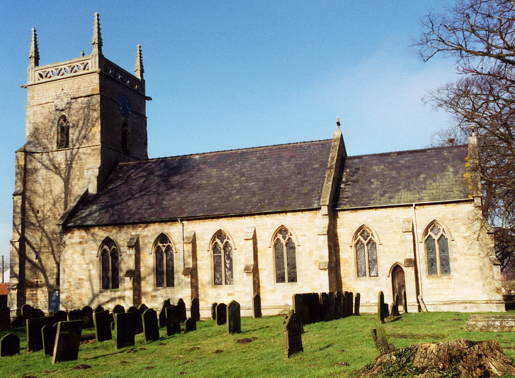
- The Anglican parish church is dedicated to Saint Andrew.
- The church was built in 1749 to replace an earlier chapel.
- The church was rebuilt again, except for the tower, in 1857.
- A clock was added to the tower in 1897 to commemorate the Jubilee of Queen Victoria.
- The church seats 281 people.
- There is a photograph of St Andrew's church on the Wendy PARKINSON English Church Photos web site.
- Here is a photo of St. Andrew's Church, taken by Ron COLE (who retains the copyright):
- The Anglican parish register dates from 1683.
- We have the beginning of a Parish Register Extract in a text file for your use. Your corrections and additions are welcomed.
- The Lincolnshire FHS has published several marriage indexes and a burial index for the Graffoe Deanery to make your search easier.
- There is, or at least was, a Weslyan Chapel and a Primitive Methodist Chapel. The Wesleyan chapel was rebuilt on a new site in 1888 and the Primitive Methodists enlarged their chapel in 1872. For information and assistance in researching these chapels, see our non-conformist religions page.
- There's a photograph of the Wesleyan Chapel on Geo-graph taken by Richard CROFT.
- Check our Church Records page for county-wide resources.
- The parish was in the South West sub-district of the Lincoln Registration District.
- Check our Civil Registration page for sources and background on Civil Registration which began in July, 1837.
Potterhanworth is a village and parish about 6 miles southeast of Lincoln in Lincolnshire, just north of Nocton, and directly north of Sleaford. Branston parish is to the north. The parish covers about 4,200 acres and includes the hamlet of Booths.
The name is spelled a few diferent ways, including Potterhamworth and as two words: Potter Hanworth. If you are planning a visit:
- Take the B1178 trunk road east off of the A15 (south out of Lincoln). This travels through the heart of the village.
- See our touring page for more sources.
- Ask for a calculation of the distance from Potterhanworth to another place.
- Great quantities of Roman pottery were found on the site of the schoolhouse and the water tower at the time of their erection.
- The village was a local market where produce from the surrounding countryside was bought and sold.
- The village may have been Boston's hinterland. Thirteenth and fourteenth century pottery found in the town was made in Bourne, Potter Hanworth, Lincoln, Nottingham, and Grimston.
- The village had a station on the Great Northern and Great Eastern joint railway.
- See our Maps page for additional resources.
You can see maps centred on OS grid reference TF056663 (Lat/Lon: 53.183356, -0.421686), Potterhanworth which are provided by:
- OpenStreetMap
- Google Maps
- StreetMap (Current Ordnance Survey maps)
- Bing (was Multimap)
- Old Maps Online
- National Library of Scotland (Old Ordnance Survey maps)
- Vision of Britain (Click "Historical units & statistics" for administrative areas.)
- English Jurisdictions in 1851 (Unfortunately the LDS have removed the facility to enable us to specify a starting location, you will need to search yourself on their map.)
- Magic (Geographic information) (Click + on map if it doesn't show)
- GeoHack (Links to on-line maps and location specific services.)
- All places within the same township/parish shown on an Openstreetmap map.
- Nearby townships/parishes shown on an Openstreetmap map.
- Nearby places shown on an Openstreetmap map.
- There's a photograph of the War Memorial on Geo-graph taken by Richard CROFT.
- There is evidence that pottery was made here in Roman times.
- Hanworth gets it's prefix 'Potter' from the medieval pottery kilns which produced a tough, if rather utilitarian, shelly pottery. [Tony Page]
- Although listed in many sources as one word, Potterhanworth is generally spelled as two words by the locals.
- This place was an ancient parish in Lincoln County and became a modern Civil Parish when those were established.
- The parish was in the ancient Liberty of Lincoln and the second division of the Langoe Wapentake in the North Kesteven division of the county, in the parts of Kesteven.
- You may contact the local Parish Council regarding civic or political issues, but they are not staffed to answer family history questions.
- For today's district governance, see the North Kesteven District Council.
- Bastardy cases would be heard in the Lincoln South petty session hearings.
- The parish had 8 acres and 3 rods of land dedicated to the poor of the parish.
- In 1826, Richard NEWBEE, T. LYON and W. TYRHITT started a charity based on the interest from £59, to be distributed to the poor annually.
- As a result of the 1834 Poor Law Amendment Act, the parish became part of the Lincoln Poor Law Union.
Year Inhabitants 1801 303 1811 364 1831 402 1841 439 1851 447 1861 413 1871 447 1881 436 1891 430 1901 480 1911 434 1921 466 1991 562
- A Public Elementary School was built here in 1856 and enlarged in 1910 to hold up to 100 children.
- There's a photograph of the school on Geo-graph taken by Richard CROFT.
- For more on researching school records, see our Schools Research page.