
Hide
St Mildred Bread-street
hide
Hide
hide
Hide
Hide
Hide
"ST. MILDRED, Bread-Street, the church of, stands on the east side of Bread-street, and is so called from its situation, and from being dedicated to Mildred, a Saxon saint, daughter of Merwaldus, and brother to Penda, King of the Mercians. . . It is a rectory, founded and built by Lord Trenchant, of St. Alban's, about the year 1300, and enlarged in 1428, by Sir John Chadworth . . . The old church was burned down in 1666, and rebuilt in 1683 by Sir Christopher Wren. The front towards Bread-street is built of Portland stone, in a picturesque Italian style. . . After the fire of London, the parish of St. Margaret Moses, was united to it by act of parliament. . . These united parishes are a rectory, in the city, diocese and archdeaconry of London, and in the alternate patronage of the Lord Chancellor, for the crown, and a private individual. The present rector is the Rev. T. G. Ackland, D.D., who was instituted by the Lord Chancellor in 1818." [James Elmes. A Topographical Dictionary of London and its Environs (1831) - transcribed by Brian Randell]
Hide
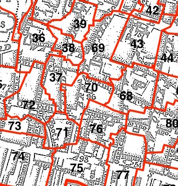
This parish - no. 70 in the above map - is located in Bread Street Ward.
The church was destroyed in 1666, rebuilt by Wren.
The parish was later united with St Mary le Bow 1954.
The church was destroyed 1940, and the site sold.
Hide
London Metropolitan Archive holdings for St Mildred Bread-street.
Online Parish Register Images and Indexes for St Mildred Bread-street parish are provided by, or at various subscription sites via, the LDS FamilySearch wiki.
No non-Church of England denominations have been identified for St Mildred Bread Street with St Margaret Moses [LDS FamilySearch Wiki].
Bannerman, William Bruce. The registers of St. Mildred, Bread Street, and of St. Margaret Moses, Friday Street, London. [Mitchell, Hughes and Clarke, printers] (1912) 125 pp. [Full text]
Wikipedia page on St Mildred Bread-street.
- Ask for a calculation of the distance from St Mildred Bread-street to another place.
Summary history of St Mildred Bread-street parish, from the Worshipful Company of Parish Clerks.
Public Houses, Inns & Taverns of the parish of St Mildred Bread-street - provides "information from census records, trade directories, etc."
You can see maps centred on OS grid reference TQ323810 (Lat/Lon: 51.512447, -0.095068), St Mildred Bread-street which are provided by:
- OpenStreetMap
- Google Maps
- StreetMap (Current Ordnance Survey maps)
- Bing (was Multimap)
- Old Maps Online
- National Library of Scotland (Old Ordnance Survey maps)
- Vision of Britain (Click "Historical units & statistics" for administrative areas.)
- English Jurisdictions in 1851 (Unfortunately the LDS have removed the facility to enable us to specify a starting location, you will need to search yourself on their map.)
- Magic (Geographic information) (Click + on map if it doesn't show)
- GeoHack (Links to on-line maps and location specific services.)
- All places within the same township/parish shown on an Openstreetmap map.
- Nearby townships/parishes shown on an Openstreetmap map.
- Nearby places shown on an Openstreetmap map.
Surnames from the 1881 census in the St Mildred Bread and St Mildred Bread Street districts.
Clerical career summaries for the parish of (i) St Mildred Bread-street and (ii) St Mildred Bread Street With St Margaret Moses, from the Clergy of the Church of England Database website.
Sources for listings of taxpayer names for St Mildred Bread-street parish, listed on the LDS FamilySearch wiki.