
Hide
Mitford
hide
Hide
hide
Hide
Hide
Hide
"MITFORD, a parish partly in the west division of Morpeth Ward, and partly in the west division of Castle Ward, comprehends the townships of Benridge, Edington, High and Low Highlaws, Mitford, Molesdon, Newton Park, Newton Underwood, Nunriding, Pigdon, Spittle Hill, and Throphill. It is bounded by the parishes and chapelries of Long Horsley, Hartburn, Meldon, Whalton, Morpeth, and Hebron, and comprises an area of 9,595 statute acres. The population in 1801, was 676; in 1811, 630; in 1821, 625; in 1831, 701; in 1841, 733; and in 1851, 700 souls. This district possesses rich and fertile soil, and is well watered by the rivers Font and Wansbeck." [From History, Topography, and Directory of Northumberland, Whellan, 1855].
Hide
- "The Diaries of William Brewis of Mitford,Morpeth" by J.Foster & Dr M.Smith ISBN 978-0-9538443-8-8. Wagtail Press
- Northumberland County Record Office holds copies of Census Returns 1841 - 1891 and provides a useful User Guide
- The 1851 Census Index (microfiche CN21) Hartburn, Netherwitton, Longhorsley, Hebron, Mitford and Meldon (PRO piece HO107/2418 folios 1-145) (Type B) (Book) published by the https://www.ndfhs.org.uk/ may be of value to researchers interested in this parish.
- Mitford - Church Records - links and information.
- This area is within Northumberland Central Registration District.
- Certificates of birth, death and marriage can be ordered from Northumberland County Council.
- Photographs of Mitford, Newton Mill and Nunriding from Les Bell's Northumberland Cam website.
- The section of The National Gazetteer (1868) relating to this parish - transcribed by Colin Hinson.
- Ask for a calculation of the distance from Mitford to another place.
- The history of Mitford Parish is included in:- Hodgson, J., History of Northumberland, Part 2, Volume 2. Newcastle, 1832. (Available on fiche from Ancestral Indexes).
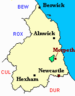
- Mitford - Maps - links and information.
You can see maps centred on OS grid reference NZ153866 (Lat/Lon: 55.17345, -1.76069), Mitford which are provided by:
- OpenStreetMap
- Google Maps
- StreetMap (Current Ordnance Survey maps)
- Bing (was Multimap)
- Old Maps Online
- National Library of Scotland (Old Ordnance Survey maps)
- Vision of Britain (Click "Historical units & statistics" for administrative areas.)
- English Jurisdictions in 1851 (Unfortunately the LDS have removed the facility to enable us to specify a starting location, you will need to search yourself on their map.)
- Magic (Geographic information) (Click + on map if it doesn't show)
- GeoHack (Links to on-line maps and location specific services.)
- All places within the same township/parish shown on an Openstreetmap map.
- Nearby townships/parishes shown on an Openstreetmap map.
- Nearby places shown on an Openstreetmap map.